Huguenot Memorial Bridge
Huguenot Memorial Bridge is located in Henrico County and the independent city of Richmond, Virginia. It carries State Route 147 across the former Chesapeake and Ohio Railway (now the James River Line of CSX Transportation), the James River and Kanawha Canal, and the James River in the Fall Line region above the head of navigation at Richmond.
Huguenot Memorial Bridge | |
|---|---|
| Coordinates | 37°33′42″N 77°32′38″W |
| Carries | |
| Crosses | James River |
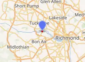
| Locale | Henrico, Virginia |
| Official name | Huguenot Memorial Bridge |
| Other name(s) | Huguenot Bridge |
| Maintained by | Virginia Department of Transportation |
| Characteristics | |
| Total length | 2900 ft (884 m) |
| History | |
| Constructed by | T. A. Loving Company |
| Opened | 1950 |
| Statistics | |
| Toll | none |
| Location | |
| |
The Huguenot Memorial Bridge, which connects Southside (Richmond, Virginia) to urban Richmond, was completed in 1950. The 2900 ft (884 m) span replaced the low-level Westham Bridge which had been built as a toll bridge in 1911. The old bridge was subject to flooding and was inadequate for traffic in the growing suburban area.
The Huguenot Memorial Bridge was named in honor of the French Huguenot settlers who came to the area in the 18th century to escape religious persecution in France. It is owned by the Virginia Department of Transportation (VDOT) and is the westernmost bridge over the James River in the metropolitan Richmond area that is open to pedestrians.
The 1950 original bridge was facing significant structural issues. After years of problems maintaining the deck and pavement, as of 2008, a replacement was included in the limited number of high priority projects underway with the Virginia Department of Transportation (VDOT). Construction began in 2010 and completed in 2013.[1]
References
External links
Crossings of the James River | ||||
|---|---|---|---|---|
| ||||
