Huntington Park, New Zealand
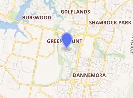
Huntington Park is an eastern suburb of the city of Auckland, New Zealand. The area is bounded on the north by Ti Rakau Drive, on the east by Te Irirangi Drive, and to the south and west by the Greenmount Drainage Reserve. The area is called Greenmount on some maps. The northeast corner contains The Hub shopping mall.
Huntington Park | |
|---|---|
Suburb | |
| |
| Country | New Zealand |
| Local authority | Auckland Council |
| Electoral ward | Howick Ward |
| Local board | Howick Local Board |
| Population (2018)[1] | |
| • Total | 1,902 |
| Burswood | Golflands | Northpark |
| East Tāmaki |
|
Northpark |
| East Tāmaki | East Tāmaki | East Tāmaki |
Most of the houses were built in the 1990s.[2] Even in 1998, the area was rural.[3]
The Guy family farmed in the area for 40 years from the late 19th century. The Guy homestead, built in 1898, was badly damaged by a suspected arson in 2012.[4] The house was later restored.[5][6]
Demographics
| Year | Pop. | ±% p.a. |
|---|---|---|
| 2006 | 1,848 | — |
| 2013 | 1,974 | +0.95% |
| 2018 | 1,902 | −0.74% |
| Source: [1] | ||
Huntington Park had a population of 1,902 at the 2018 New Zealand census, a decrease of 72 people (-3.6%) since the 2013 census, and an increase of 54 people (2.9%) since the 2006 census. There were 795 households. There were 879 males and 1,020 females, giving a sex ratio of 0.86 males per female. The median age was 41.7 years, with 273 people (14.4%) aged under 15 years, 327 (17.2%) aged 15 to 29, 870 (45.7%) aged 30 to 64, and 432 (22.7%) aged 65 or older.
Ethnicities were 47.2% European/Pākehā, 3.2% Māori, 2.2% Pacific peoples, 45.4% Asian, and 6.3% other ethnicities (totals add to more than 100% since people could identify with multiple ethnicities).
The proportion of people born overseas was 59.0%, compared with 27.1% nationally.
Although some people objected to giving their religion, 39.0% had no religion, 38.3% were Christian, 5.7% were Hindu, 3.8% were Muslim, 3.9% were Buddhist and 3.8% had other religions.
Of those at least 15 years old, 459 (28.2%) people had a bachelor or higher degree, and 198 (12.2%) people had no formal qualifications. The median income was $31,300. The employment status of those at least 15 was that 732 (44.9%) people were employed full-time, 189 (11.6%) were part-time, and 66 (4.1%) were unemployed.[1]
References
- "Statistical area 1 dataset for 2018 Census". Statistics New Zealand. March 2020. Huntington Park (154500). 2018 Census place summary: Huntington Park
- "Huntington Park, Manukau City". One Roof. Retrieved 7 September 2020.
- Auckland (Map). 1:50000. NZMS260. LINZ / Lands and Survey. 1998. § R11.
- "Historic Auckland homestead burns down". Auckland Now. 3 December 2012.
- Williamson, Jarred (27 May 2015). "Historic East Auckland homestead gets a new life". Eastern Courier.
- "Guy's Homestead". Register of Historic Places. Heritage New Zealand. Retrieved 7 September 2020.