Idaho State Highway 47
State Highway 47 (SH-47) is a 12.420-mile-long (19.988 km) state highway in the U.S. State of Idaho. SH-47 runs from U.S. Route 20 (US-20) in Ashton to near Warm River.
| ||||
|---|---|---|---|---|
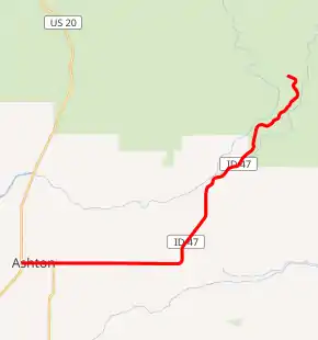
SH-47 highlighted in red | ||||
| Route information | ||||
| Maintained by ITD | ||||
| Length | 12.420 mi[1] (19.988 km) | |||
| Major junctions | ||||
| West end | ||||
| East end | 4350 East and 1900 North near Warm River | |||
| Location | ||||
| Counties | Fremont | |||
| Highway system | ||||
| ||||

Route description
SH-47 starts at an intersection with US-20 and heads due east as Main Street through Ashton. The highway continues east after an intersection with the northern terminus of SH-32, passing through Marysville as East 1300 North. Slowly, SH-47 bends to the north as Mesa Falls Scenic Byway, going through Warm River and crossing over the same-named river. SH-47 ends in the Targhee National Forest.[1][2]
Junction list
The entire route is in Fremont County.
| Location | mi[1] | km | Destinations | Notes | |
|---|---|---|---|---|---|
| Ashton | 0.000 | 0.000 | Western terminus of SH 47 | ||
| | 1.010 | 1.625 | Northern terminus of SH 32 | ||
| | 12.420 | 19.988 | 4350 East / 1900 North | Eastern terminus of SH 32 Road continues north as Mesa Falls Scenic Byway | |
| 1.000 mi = 1.609 km; 1.000 km = 0.621 mi | |||||
References
- Staff (18 December 2006). "State Highway 47". Idaho Transportation Department. Archived from the original on 12 December 2012. Retrieved 12 September 2012.
- Google (12 September 2012). "State Highway 47" (Map). Google Maps. Google. Retrieved 12 September 2012.
This article is issued from Wikipedia. The text is licensed under Creative Commons - Attribution - Sharealike. Additional terms may apply for the media files.