Idaho State Highway 48
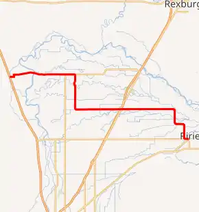
State Highway 48 (SH-48) is a 24.409-mile-long (39.282 km) state highway in the U.S. State of Idaho. SH-48 runs from Interstate 15 (I-15) near Roberts to U.S. Route 26 Business (US 26 Bus.) in Ririe.
| ||||
|---|---|---|---|---|
SH-48 highlighted in red | ||||
| Route information | ||||
| Maintained by ITD | ||||
| Length | 24.409 mi[1] (39.282 km) | |||
| Major junctions | ||||
| West end | ||||
| East end | ||||
| Location | ||||
| Counties | Jefferson, Bonneville | |||
| Highway system | ||||
| ||||

Route description
State Highway 48 starts at a diamond interchange with I-15 before heading due east on North Berrett Road through the town Roberts, where it becomes the road East 627 North. SH-48 continues north on Old Highway 91 before turning east and leaving the city of Roberts as Roberts Highway (also known as East 650 North), crossing Roberts Slough. Near the town of Lewisville, SH-48 turns south onto Saint Leon Road (alternatively known as North 3500 East), passing Midway Elementary School and Jefferson Alternative High School as it enters the town of Lewisville. SH-48 continues due south out of the city limits before turning east onto Lewisville Highway (North 3500 East). The highway passes by Philo T Farnsworth Elementary, Jefferson Elementary School, Rigby Middle School and Rigby Senior High School before entering the city of Rigby on West 1st South.[2]
In the city, SH-48 intersects U.S. Route 20 Business, providing access to the US 20 freeway as SH-48 passes underneath the freeway with no direct access. SH-48 leaves the city as Ririe Highway before passing through more farmland, turning due south onto North 4500 East and then east again on East 150 North. The highway turns south again onto North 4600 East before making a final turn east on County Line Road, crossing into Bonneville County and ending at U.S. Route 26 Business in the town of Ririe.[1][2]
Major intersections
| County | Location | mi[1] | km | Destinations | Notes |
|---|---|---|---|---|---|
| Jefferson | | 0.000– 0.106 | 0.000– 0.171 | I-15 exit 135. | |
| Rigby | 14.812 | 23.838 | |||
| Bonneville | Ririe | 24.409 | 39.282 | ||
| 1.000 mi = 1.609 km; 1.000 km = 0.621 mi | |||||
References
- Staff (18 December 2006). "State Highway 48". Idaho Transportation Department. Archived from the original on 13 December 2012. Retrieved 13 July 2012.
- Google (13 July 2012). "State Highway 48" (Map). Google Maps. Google. Retrieved 13 July 2012.
