Idaho State Highway 66
State Highway 66 (SH-66) is a 0.992-mile-long (1.596 km) state highway located entirely within Latah County in North Central Idaho. SH-66 runs from the Washington state line in unincorporated Latah County east to U.S. Route 95 (US-95) north of Viola. The highway is maintained by the Idaho Transportation Department.
| ||||
|---|---|---|---|---|
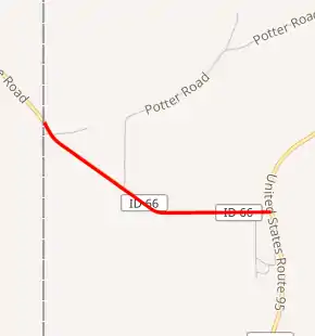
SH-66 highlighted in red | ||||
| Route information | ||||
| Maintained by ITD | ||||
| Length | 0.992 mi[1] (1.596 km) | |||
| Major junctions | ||||
| West end | Washington state line in unincorporated Latah County | |||
| East end | ||||
| Location | ||||
| Counties | Latah | |||
| Highway system | ||||
| ||||

Route description
SH-66 begins at the Washington state line northwest of Viola; the route continues northwest into Washington as Palouse Cove Road. From here, the highway heads southeast through a rural area. After passing Potter Road, the route turns to the west. Shortly after passing Weber Road, SH-66 terminates at a 3-way junction with US-95 north of Viola. The route is a two-lane undivided road for its entire length.[2][1]
Major intersections
The entire route is in Latah County.
| Location | mi[1] | km | Destinations | Notes | |
|---|---|---|---|---|---|
| | 0.000 | 0.000 | Palouse Cove Road | Washington state line and western terminus | |
| | 0.992 | 1.596 | Eastern terminus | ||
| 1.000 mi = 1.609 km; 1.000 km = 0.621 mi | |||||
References
- "State Highway 66 Milepoint Log". Idaho Transportation Department. Archived from the original on May 12, 2012. Retrieved April 29, 2012.
- Google (April 29, 2012). "Overview map of State Highway 66" (Map). Google Maps. Google. Retrieved April 29, 2012.
