Iinan, Shimane
Iinan (飯南町, Iinan-chō) is a town located in Iishi District, Shimane Prefecture, Japan.
Iinan
飯南町 | |||||||||||
|---|---|---|---|---|---|---|---|---|---|---|---|
Town | |||||||||||
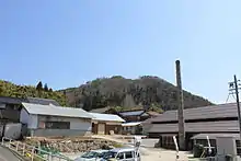
 Iinan town hall | |||||||||||
 Flag | |||||||||||
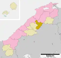
 Location of Iinan in Shimane Prefecture | |||||||||||
 Iinan Location in Japan | |||||||||||
| Coordinates: 35°0′N 132°43′E | |||||||||||
| Country | Japan | ||||||||||
| Region | Chūgoku San'in | ||||||||||
| Prefecture | Shimane Prefecture | ||||||||||
| District | Iishi | ||||||||||
| Area | |||||||||||
| • Total | 242.84 km2 (93.76 sq mi) | ||||||||||
| Population (March 1, 2017) | |||||||||||
| • Total | 4,908 | ||||||||||
| • Density | 20/km2 (52/sq mi) | ||||||||||
| Time zone | UTC+09:00 (JST) | ||||||||||
| City hall address | 890 Shimoakana, Iinan-machi 690-3513 | ||||||||||
| Website | www | ||||||||||
| |||||||||||
It was formed on January 1, 2005 from the merger of the towns of Tonbara and Akagi, both from Iishi District.
As of March 1, 2017 the town has a population of 4,908 and a density of 20 persons per km². The area is 242.84 km².
Geography
Located on the border of Shimane Prefecture and Hiroshima Prefecture, the Gōno River flows to its west. The town is part of the Hiba-Dōgo-Taishaku Quasi-National Park.[1]
Mountains: Mt. Oyorogi, Mt. Kotobiki, Mt. Mengame
Rivers: Kando River, Tonbara River, Akana River, Ono River (Tributary of Kando River)
Lakes: Lake Kijima (Kijima Dam lake)
Subdivisions
- Akana
- Kijima
- Oda
- Tani
- Tonbara, formerly part of Tonbara, Shimane
Surrounding municipalities
Population
Iinan Population Change over Time[2]
|
| ||||||||||||||||||||||
| (Population of Tonbara and Akagi added together before 2005) | |||||||||||||||||||||||
Transportation
National Highways
- National Highway 54
- National Highway 184
Roadside Stations
- Roadside Station Akagi Plateau
- Roadside Station Tonbara
There is no railroad access to Iinan.
Notable places

AkanaSetoyamaCastle Distant view
- Akana Castle
- It is an old castle located on top of a hill in the Akana area of the town.
- Mount Mengame
- Mount Kotobiki
- Akana Marshland
- Kotobiki Camp Area
- The Kotobiki Camp Area is located at the foot of Mount Kotobiki. It is open from late April to late October.[6]
References
- 考える社会科地図 Kangaeru Shakaika Chizu. 四谷大塚出版 Yotsuya-Ōtsuka Shuppan. 2005. p. 25.
- ja:飯南町
- (in Japanese) おかえりなさい!:島根県飯南町観光WEB Archived 2012-08-02 at Archive.today
- (in Japanese) おかえりなさい!:島根県飯南町観光WEB Archived 2007-12-09 at the Wayback Machine
- (in Japanese) おかえりなさい!:島根県飯南町観光WEB Archived 2007-12-09 at the Wayback Machine
- (in Japanese) おかえりなさい!:島根県飯南町観光WEB Archived 2007-10-12 at the Wayback Machine
External links
 Media related to Iinan, Shimane at Wikimedia Commons
- Iinan official website (in Japanese)
This article is issued from Wikipedia. The text is licensed under Creative Commons - Attribution - Sharealike. Additional terms may apply for the media files.
