Illinois Route 73
Illinois Route 73 is a north–south state highway in northwest Illinois. It runs from the U.S. Route 52/Illinois Route 64 concurrency south of Lanark north to the Wisconsin border north of Winslow. This is a distance of 29.32 miles (47.19 km).[1]
| ||||
|---|---|---|---|---|
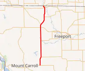
Illinois Route 73 highlighted in red | ||||
| Route information | ||||
| Maintained by IDOT | ||||
| Length | 29.32 mi[1] (47.19 km) | |||
| Existed | 1924[2]–present | |||
| Major junctions | ||||
| South end | ||||
| North end | ||||
| Location | ||||
| Counties | Carroll, Stephenson | |||
| Highway system | ||||
| ||||

Route description
Illinois 73 is a two-lane surface road for its entire length. At its northern terminus, Illinois 73 becomes County Highway M in Green County, Wisconsin. This is the only state highway that does not either continue as another state highway, or end at a ferry crossing (current or former).[2]
History
SBI Route 73 existed from Illinois Route 72 north of Lanark to Winslow. Around 1982, it replaced Illinois 72 from north of Lanark south to U.S. Route 52.[2]
Major intersections
| County | Location | mi[3] | km | Destinations | Notes |
|---|---|---|---|---|---|
| Carroll | Lanark | 0.00 | 0.00 | Southern terminus of IL 73 | |
| 4.2 | 6.8 | Western terminus of IL 72 | |||
| Stephenson | Lena | 18.1 | 29.1 | ||
| Winslow | 29.32 | 47.19 | Continuation into Wisconsin | ||
| 1.000 mi = 1.609 km; 1.000 km = 0.621 mi | |||||
External links
References
- Illinois Technology Transfer Center (2007). "T2 GIS Data". Retrieved 2007-11-08.
- Carlson, Rich. Illinois Highways Page: Routes 61 through 80. Last updated March 15, 2005. Retrieved April 2, 2006.
- Google (February 22, 2017). "Overview Map of IL 73" (Map). Google Maps. Google. Retrieved February 22, 2017.
This article is issued from Wikipedia. The text is licensed under Creative Commons - Attribution - Sharealike. Additional terms may apply for the media files.