Illinois Route 76
Illinois Route 76 is a north–south state road in far north-central Illinois. It runs from the U.S. Highway 20 bypass around Belvidere (and business route to Rockford) north to the Wisconsin State Line at Highway 140. This is a distance of 15.67 miles (25.22 km).[1]
| ||||
|---|---|---|---|---|
| Fairgrounds Road | ||||
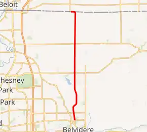
IL 76 highlighted in red | ||||
| Route information | ||||
| Maintained by IDOT | ||||
| Length | 15.67 mi[1] (25.22 km) | |||
| Existed | 1924[2]–present | |||
| Major junctions | ||||
| South end | ||||
| North end | ||||
| Location | ||||
| Counties | Boone | |||
| Highway system | ||||
| ||||

Route description
Illinois 76 is an undivided two-lane rural highway for its entire length. Starting in US 20 Bus. in Belvidere, IL 76 travels north. It then intersects Illinois Route 173 near Poplar Grove. At the Wisconsin state line, IL 76 curves west. As soon as the road curves north, it enters Wisconsin. At that point, the road becomes WIS 140.[3]
History
Initially, only the section between IL 173 and US 20/IL 5 (now mostly US 20 Bus.) in downtown Belvidere was signed as IL 76.[4] In 1935, IL 76 extended north to the state line. Also, IL 76 was slightly truncated due to the rerouting of US 20. Also, IL 5 then only appeared on the former stretch of US 20 from Rockford to Belvidere.[5] Since 1967, part of IL 5 became part of US 20.[6] Another truncation happened in Belvidere. Since 1989, US 20 Bus. bypassed downtown Belvidere. As a result, IL 76 no longer ended in downtown but instead ended north of downtown.[7]
Major intersections
The entire route is in Boone County.
| Location | mi[3] | km | Destinations | Notes | |
|---|---|---|---|---|---|
| Belvidere | 0.00 | 0.00 | Southern terminus of IL 76. | ||
| Poplar Grove | 6.8 | 10.9 | |||
| Capron | 15.67 | 25.22 | Northern terminus of IL 76; Wisconsin state line | ||
| 1.000 mi = 1.609 km; 1.000 km = 0.621 mi | |||||
References
- Illinois Technology Transfer Center (2006). "T2 GIS Data". Retrieved 2007-11-08.
- Carlson, Rich. Illinois Highways Page: Routes 61 thru 80. Last updated March 15, 2005. Retrieved April 2, 2006.
- Google (February 22, 2017). "Overview Map of IL 76" (Map). Google Maps. Google. Retrieved February 22, 2017.
- Illinois Secretary of State; H.M. Gousha (1929). Illinois Official Auto Road Map (Map). [c. 1:950,000 and c. 1:1,110,000]. Springfield: Illinois Secretary of State. Retrieved November 28, 2020 – via Illinois Digital Archives.
- Illinois Secretary of State; H.M. Gousha (1935). Official Road Map Illinois (Map). [c. 1:950,000 and c. 1:1,110,000]. Springfield: Illinois Secretary of State. Retrieved November 28, 2020 – via Illinois Digital Archives.
- Illinois Division of Highways; Rand McNally (1967). Illinois Official Highway Map (Map). [1:772,500]. Springfield: Illinois Division of Highways. Retrieved November 28, 2020 – via Illinois Digital Archives.
- Illinois Department of Transportation (1989). Illinois Highway Map (Map) (1989–1990 ed.). [1:762,500]. Springfield: Illinois Department of Transportation. Retrieved November 28, 2020 – via Illinois Digital Archives.