Indawgyi Lake
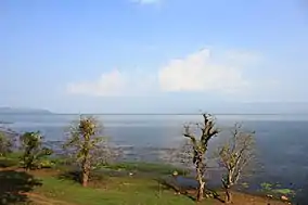
Indawgyi Lake (Burmese: အင်းတော်ကြီး; MLCTS: ang: dau kri: [ʔɪ́ɰ̃dɔ̀dʒḭ́]) is one of the largest inland lakes in Southeast Asia. It is located in Mohnyin Township in the Kachin State of Myanmar. The lake measures 13 kilometres (8.1 mi) east to west, and 24 kilometres (15 mi) north to south.[1] There are over 20 villages around the lake.[2] The predominant ethnic groups living in the surroundings of the lake are the Shan and the Kachin, who mainly practise agriculture. It is 546 feet (166 m) above sea level.[3] The lake is the main feature of the Indawgyi Lake Wildlife Sanctuary.

| Indawgyi Lake (အင်းတော်ကြီး) | |
|---|---|
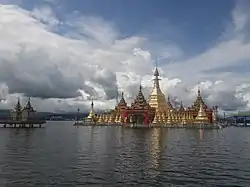
 Indawgyi Pagoda at Indawgyi Lake | |
 Indawgyi Lake (အင်းတော်ကြီး) | |
| Location | Kachin State |
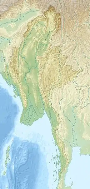
| Coordinates | 25°8′N 96°20′E |
| Type | Tectonic |
| Primary outflows | Indaw Chaung (→Irrawaddy River→Andaman Sea) |
| Basin countries | Myanmar |
| Max. length | 24 km (15 mi) |
| Max. width | 13 km (8.1 mi) |
| Average depth | 22 meters (72.2 feet) |
It has a length of 14 miles (23 km), width of seven miles and an area of 100 square miles (260 km2). There are 11 village-tracts, 36 villages around the lake; 13 villages are on the bank of the lake.[3]
Flora and fauna
Indawgyi Lake is within the confines of Indawgyi Lake Wildlife Sanctuary, which was established in 1999 by the Ministry of Ecotourism. The sanctuary, which encompasses 780 km2 (300 sq mi), contains a variety of animal species, including rare mammals and birds.[2] Indawgyi host more than 65 species of fish, but there are no endemics (a few fish that historically were believed to be endemic are now known to also occur elsewhere).[4]
One of Myanmar's important bird areas, 10 endangered species can be found. Of these species, greylag geese, Oriental darter and purple swamphen are prominent during the month of January.[5] A tour of the lake by motor canoe allows one to view a large array of wetland species. It appears that the lake and surrounding wetlands provide an important winter feeding habitat. Many local fisher folk ply its waters and surrounding village waste threaten water quality. However annual monsoons serve to flush and refresh its waters.
Geology
Indawgyi Lake is a sag pond, formed at a releasing step-over, with extensional faults associated with the Sagaing Fault – an active strike-slip fault the runs through Myanmar. Movement along the fault created a pull-apart basin similar to the Salton Trough of California.[6] Oral reports suggest the area was once a fertile valley when it suddenly flooded following an earthquake, submerging a village and killing its residents, although it remains unknown if the lake was a result of subsidence or a landslide.[6][7]

References
- "Indawgyi Lake". Encyclopædia Britannica Online. Retrieved 2006-02-20.
- "Indawgyi Lake Wildlife Sanctuary". Ministry of Ecotourism. Archived from the original on 2006-03-25. Retrieved 2006-02-20.
- http://www.mrtv3.net.mm/newpaper/209newsn.pdf%5B%5D Page 11 Column 2
- Miao, W.; S.D. Silva; B. Davy, eds. (2010). Inland Fisheries Enhancement and Conservation in Asia. FAO Regional Office for Asia and the Pacific, Bangkok, Thailand. pp. 95–96. ISBN 978-92-5-106751-2.
- "Indawgyi Lake and Indawgyi River". BirdLife International. Retrieved 2006-12-17.
- Soe Thura Tun, Watkinson, Ian M. "The Sagaing Fault" (PDF). Myanmar: Geology, Resources and Tectonics: 51 – via Geological Society, London, Memoir.
- Than Htun (2019-05-09). "Magnificent Indawgyi Lake aspiring to be inscribed as geopark". Myanmar Digital News.
External links
- Indawgyi lake wildlife sanctuary - Kachin state Asterism
- Fauna Flora International's video witch talk about fish decreasing