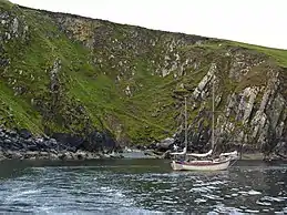
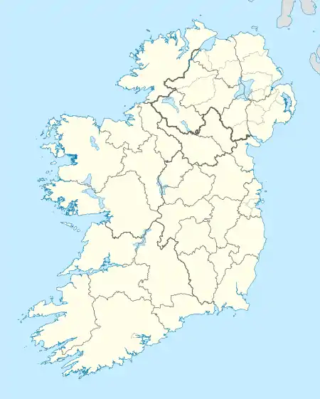
Inishvickillane
Inishvickillane or Inishvickillaun (from Irish: Inis Mhic Aoibhleáin meaning 'Mac Killane's island')[1] is one of the Blasket Islands of County Kerry, Ireland.
| Native name: Inis Mhic Aoibhleáin | |
|---|---|
 | |
 Inishvickillane | |
| Geography | |
| Location | Atlantic Ocean |
| Coordinates | 52.04350°N 10.60829°W |
| Archipelago | Blasket Islands |
| Highest elevation | 200 m (700 ft) |
| Administration | |
Ireland | |
| Province | Munster |
| County | County Kerry |
| Demographics | |
| Population | 0 (0) |
| Pop. density | 0/km2 (0/sq mi) |
| Inishvickillane | |
|---|---|
| Highest point | |
| Elevation | 135 m (443 ft) |
| Prominence | 135 m (443 ft) |
| Dimensions | |
| Area | 0.692 km2 (0.267 sq mi) |
| Geography | |
| OSI/OSNI grid | V211911 |
History
Referred to by Blasket islanders as "The Inis",[2] Inishvickillane was intermittently inhabited during the nineteenth and early twentieth centuries, by one or more families. There are extensive ruins of ancient stone buildings and a house was built in the 1970s by Taoiseach Charles Haughey, who owned the island and used it as a holiday home.
Inishvickillane will be the first land in Europe to experience the solar eclipse of 23 September 2090.[3]
Geography
Apart from Tearaght and some rocks, this island is the most western land of Ireland; it is possibly the most western part of the country that had anything like normal habitation, since Tearaght's sole inhabitants seem to have been the keepers of the lighthouse there before that was automated in 1988.
Nature
Inishvickillane holds important seabird colonies, being especially notable for northern fulmar, European storm-petrel and Atlantic puffin. A herd of red deer was introduced to the island by Haughey.
References
- Placenames Database of Ireland
- J. & R. Stagles, The Blasket Islands: Next Parish America. O'Brien Press, Dublin, 1980
- http://eclipse.gsfc.nasa.gov/SEsearch/SEsearchmap.php?Ecl=20900923
