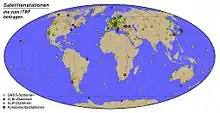
International Terrestrial Reference System and Frame
The International Terrestrial Reference System (ITRS) describes procedures for creating reference frames suitable for use with measurements on or near the Earth's surface. This is done in much the same way that a physical standard might be described as a set of procedures for creating a realization of that standard. The ITRS defines a geocentric system of coordinates using the SI system of measurement.
An International Terrestrial Reference Frame (ITRF) is a realization of the ITRS. Its origin is at the center of mass of the whole earth including the oceans and atmosphere. New ITRF solutions are produced every few years, using the latest mathematical and surveying techniques to attempt to realize the ITRS as precisely as possible. Due to experimental error, any given ITRF will differ very slightly from any other realization of the ITRF. The difference between the latest WGS 84 and the latest ITRF (as of 2006) is only a few centimeters.[1]
The ITRS and ITRF solutions are maintained by the International Earth Rotation and Reference Systems Service (IERS). Practical navigation systems are in general referenced to a specific ITRF solution, or to their own coordinate systems which are then referenced to an ITRF solution. For example, the Galileo Terrestrial Reference Frame (GTRF) is used for the Galileo navigation system; currently defined as ITRF2005 by the European Space Agency.[2]
ITRF solutions
The ITRF realizations developed from the ITRS since 1992 include[3]
| Name | Epoch | EPSG code |
Notes |
|---|---|---|---|
| ITRF92 | 1988.0 | 4914 | First realization of the ITRS |
| ITRF93 | 1988.0 | 4915 | |
| ITRF94 | 1993.0 | 4916 | |
| ITRF96 | 1997.0 | 4917 | |
| ITRF97 | 1997.0 | 4918 | |
| ITRF2000 | 1997.0 | 4919 | First solution that combines unconstrained space geodesy solutions without a tectonic plate motion model[4] |
| ITRF2005 | 2000.0 | 4896 | Constructed with input data under the form of time series of station positions and Earth Orientation Parameters[5] |
| ITRF2008 | 2005.0 | 5332 | Includes tropospheric modeling and improved solution methods.[6] |
| ITRF2014 | 2010.0 | 7789 | Generated with an enhanced modeling of nonlinear station motions[7] |
See also
References
- Clynch, James R. (February 2006). "Earth coordinates" (PDF). GPS Geodesy and Geophysics. James R. Clynch. Retrieved 24 March 2016.
- "Reference Frames in GNSS". Navipedia. European Space Agency.
- "International Terrestrial Reference Frame 2014 (ITRF2014)". Quality Positioning Services B.V. Retrieved 3 October 2019.
- Altamimi, Zuheir; Sillard, Patrick; Boucher, Claude (2002). "ITRF2000: A new release of the International Terrestrial Reference Frame for earth science applications". Journal of Geophysical Research: Solid Earth. 107 (B10): ETG 2-1–ETG 2-19. Bibcode:2002JGRB..107.2214A. doi:10.1029/2001JB000561.
- Altamimi, Z.; Collilieux, X.; Legrand, J.; Garayt, B.; Boucher, C. (2007). "ITRF2005: A new release of the International Terrestrial Reference Frame based on time series of station positions and Earth Orientation Parameters". Journal of Geophysical Research: Solid Earth. 112 (B9): B09401. Bibcode:2007JGRB..112.9401A. doi:10.1029/2007JB004949. hdl:10338.dmlcz/141752.
- Altamimi, Zuheir; Collilieux, Xavier; Métivier, Laurent (3 February 2011). "ITRF2008: an improved solution of the international terrestrial reference frame". Journal of Geodesy. 85 (8): 457–473. Bibcode:2011JGeod..85..457A. doi:10.1007/s00190-011-0444-4.
- Altamimi, Zuheir; Rebischung, Paul; Métivier, Laurent; Collilieux, Xavier (2016). "ITRF2014: A new release of the International Terrestrial Reference Frame modeling nonlinear station motions". Journal of Geophysical Research: Solid Earth. 121 (8): 6109–6131. Bibcode:2016JGRB..121.6109A. doi:10.1002/2016JB013098.
External links
- What is ITRF?
- Terrestrial reference systems and frames (chapter 4 of IERS Conventions 2010)
