Irondequoit Creek
Irondequoit Creek is a stream in eastern Monroe County, New York that feeds Irondequoit Bay. It begins in rural West Bloomfield in Ontario County, flowing north into the town of Mendon in Monroe County. Accumulating a few small tributaries, it twists eastward back into the Ontario County town of Victor, then back north into Monroe County, where it flows through the towns of Perinton and Penfield on its way to the bay. It also skirts the edge of the combined town and village of East Rochester.
| Irondequoit Creek | |
|---|---|
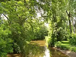 Irondequoit Creek in the town of Penfield, New York. | |
| Location | |
| Country | United States |
| State | New York |
| Physical characteristics | |
| Source | |
| • location | Ontario Country, New York |
| • coordinates | 42°55′49″N 77°31′40″W |
| Mouth | Irondequoit Bay |
• location | Monroe Country, New York |
• coordinates | 43°10′39″N 77°31′32″W |
| Basin features | |
| Tributaries | |
| • left | Allen Creek |
| • right | Trout Creek, Thomas Creek |
The creek is believed to lie in a valley carved out by a pre-glacial Genesee River, which at the time would have flowed into Lake Ontario where Irondequoit Bay does today. Glacial debris caused the river to be rerouted as the glaciers retreated, leaving only the comparatively small creek (Rogers 1893).
The first settlements in the town of Penfield sprang up along the creek, as its waters were well suited to mills. The Daisy Flour Mill is the last of over a dozen mills that once used the creek's waters.
The creek's valley caused a problem for the engineers of the original Erie Canal, who ultimately had to build the Great Embankment aqueduct to bridge the valley near Bushnell's Basin (Fairchild 1896:134, Farley 2010, Schoff:505).
The creek is stocked annually with fish by the New York State Department of Environmental Conservation for year-round fishing.
References
- Fairchild, Herman L. (1896-02-03), "Kame areas in Western New York south of Irondequoit and Sodus bays" (PDF), The Journal of Geology, 4 (2): 129–59, doi:10.1086/607458, ISSN 0022-1376
- Farley, Doug (2010-02-20), "Canal discovery: the Irondequoit Embankment", Lockport Union-Sun & Journal
- Rogers, Brownell (1893-03-03), "The Genesee River", Science, 21 (526): 121, doi:10.1126/science.ns-21.526.121, ISSN 0036-8075
- Schoff, Wilfred H. (1915), "The New York State Barge Canal. Part II", Bulletin of the American Geographical Society, 47 (7): 498–508, doi:10.2307/201433, ISSN 0190-5929, JSTOR 201433
"Irondequoit Creek". Geographic Names Information System. United States Geological Survey. Retrieved 2010-04-30.
| Authority control |
|
|---|