Isaac Branch (St. Jones River tributary)
Isaac Branch is a 10.13 mi (16.30 km) long 2nd order tributary to the St. Jones River in Kent County, Delaware.
| Isaac Branch Tributary to St. Jones River | |
|---|---|
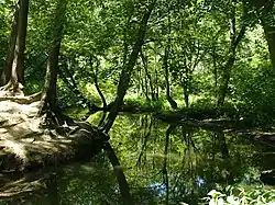 Isaac Branch at Breaknock Park | |
 Location of Isaac Branch mouth  Isaac Branch (St. Jones River tributary) (the United States) | |
| Location | |
| Country | United States |
| State | Delaware |
| County | Kent |
| City | Dover Camden Wyoming |
| Physical characteristics | |
| Source | divide between Isaac Branch and Cahoon Branch |
| • location | about 1 mile southeast of Pearsons Corner, Delaware |
| • coordinates | 39°08′26″N 075°38′28″W[1] |
| • elevation | 67 ft (20 m)[2] |
| Mouth | St. Jones River |
• location | Dover, Delaware |
• coordinates | 39°07′45″N 075°30′08″W[1] |
• elevation | 0 ft (0 m)[2] |
| Length | 10.13 mi (16.30 km)[3] |
| Basin size | 14.82 square miles (38.4 km2)[4] |
| Discharge | |
| • location | St. Jones River |
| • average | 17.88 cu ft/s (0.506 m3/s) at mouth with St. Jones River[4] |
| Basin features | |
| Progression | east |
| River system | St. Jones River |
| Tributaries | |
| • left | unnamed tributaries |
| • right | Allabands Mill Stream Almshouse Branch |
| Waterbodies | Wyoming Lake Moores Lake |
| Bridges | Hazlettville Road, Quail Run, Todds Mill Road, Wyoming Mill Road, US 13, S. State Street |
Variant names
According to the Geographic Names Information System, it has also been known historically as:[1]
- Isaac's Branch
- Isaacs Branch
- Isaac Branch
- Mill Branch
Course
Isaac Branch rises about 1 mile southeast of Pearsons Corner in Kent County, Delaware on the Cahoon Branch divide. Isaac Branch then flows east to meet the St. Jones River in Dover, Delaware.[2]
Watershed
Isaac Branch drains 14.82 square miles (38.4 km2) of area, receives about 44.8 in/year of precipitation, has a topographic wetness index of 642.83 and is about 6% forested.[4]
See also
Maps
.gif)
Course of Isaac Branch (St. Jones River tributary)
.gif)
Watershed of Isaac Branch (St. Jones River tributary)
References
- "GNIS Detail - Isaac Branch". geonames.usgs.gov. US Geological Survey. Retrieved 19 October 2019.
- "Isaac Branch Topo Map, Kent County DE (Dover Area)". TopoZone. Locality, LLC. Retrieved 19 October 2019.
- "ArcGIS Web Application". epa.maps.arcgis.com. US EPA. Retrieved 19 October 2019.
- "Isaac Branch Watershed Report". Waters Geoviewer. US EPA. Retrieved 19 October 2019.
External links
Dover (capital) | ||
| Topics |
|  |
| Society |
| |
| Cities | ||
| Towns |
| |
| Counties | ||
This article is issued from Wikipedia. The text is licensed under Creative Commons - Attribution - Sharealike. Additional terms may apply for the media files.