Isingiro
Isingiro is a town in the Western Region of Uganda. It is the main municipal, administrative, and commercial center of Isingiro District and the site of the district's headquarters.
Isingiro | |
|---|---|
 Isingiro Location in Uganda | |
| Coordinates: 00°56′27″S 30°45′06″E | |
| Country | |
| Region | Western Region |
| Sub-region | Ankole sub-region |
| District | District |
| Elevation | 4,990 ft (1,520 m) |
| Population (2014 Census) | |
| • Total | 29,721[1] |
Location
Isingiro is approximately 35 kilometres (22 mi), by road, southeast of Mbarara, the largest city in the Ankole sub-region. The town of Isingiro is surrounded by the villages of Nyakigera, Gayaza, Rwembwa, Mabona, Kibwera, and Rumira.[2] It is approximately 300 kilometres (190 mi), by road, southwest of Kampala, the capital and largest city of Uganda.[3] The coordinates of the town are 0°56'27.0"S, 30°45'06.0"E (Latitude:-0.940825; Longitude:30.751667).[4]
Population
The 2002 national population census estimated the town's population at 17,000. In 2010, the Uganda Bureau of Statistics (UBOS) estimated the population at 21,400. In 2011, UBOS estimated the mid-year population at 22,000.[5] In August 2014, the national population census put the population at 29,721.[1]
Points of interest
The following additional points of interest lie within the town limits or close to the edges of town:
- headquarters of Isingiro District administration
- offices of Isingiro Town Council
- Isingiro central market
See also
References
- UBOS (27 August 2014). "The Population of The Regions of the Republic of Uganda And All Cities And Towns of More Than 15,000 Inhabitants". Citypopulation.de Quoting Uganda Bureau of Statistics (UBOS). Retrieved 24 February 2015.
- "Map Showing Mbarara and Isingiro With Distance Marker". Globefeed.com. Retrieved 6 June 2014.
- "Distance Between Isingiro And Kampala With Map". Globefeed.com. Retrieved 6 June 2014.
- Google (5 July 2015). "Location of Isingiro At Google Maps" (Map). Google Maps. Google. Retrieved 5 July 2015.
- UBOS. "Estimated Population of Isingiro In 2002, 2010 And 2011" (PDF). Uganda Bureau of Statistics (UBOS). Archived from the original (PDF) on 7 July 2014. Retrieved 6 June 2014.
External links
Capital: Isingiro | ||
| Towns and villages | 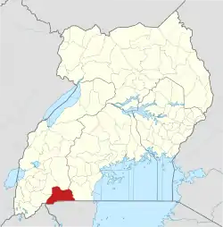 | |
| Economy | ||
| Energy | ||
| Transport | ||
| Notable landmarks | ||
| Notable people | ||
