Itki
Itki is a town in the Tadjoura Region in northwestern Djibouti. The surrounding district is rich in both livestock and fledgeling agriculture. Itki has one of the mildest climates in Djibouti.
Itki | |
|---|---|
Town | |
 | |
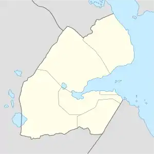 Itki Location in Djibouti | |
| Coordinates: 11°44′46″N 42°36′32″E | |
| Country | |
| Region | Tadjoura |
| Elevation | 1,467 m (4,813 ft) |
| Population | |
| • Total | 750 |
Demographics
The majority of the population of Itki is Afars.
Climate
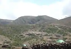
The prevailing climate in Itki is known as a local steppe climate. The warmest month of the year is June with an average temperature of 30.5 °C. In January, the average temperature is 19.1 °C. Itki is situated on top of Goda Mountains, in a mountainous and hilly area, and represents a key focal point for wildlife. The town's unusual fertility and greenery in the largely arid countryside has attracted many fauna, such as gazelles, birds and camels.
| Climate data for Itki | |||||||||||||
|---|---|---|---|---|---|---|---|---|---|---|---|---|---|
| Month | Jan | Feb | Mar | Apr | May | Jun | Jul | Aug | Sep | Oct | Nov | Dec | Year |
| Average high °C (°F) | 22.3 (72.1) |
22.8 (73.0) |
24.8 (76.6) |
26.6 (79.9) |
29.6 (85.3) |
32.3 (90.1) |
31.7 (89.1) |
30.8 (87.4) |
29.8 (85.6) |
26.9 (80.4) |
24.3 (75.7) |
22.5 (72.5) |
27.0 (80.6) |
| Average low °C (°F) | 11.3 (52.3) |
12.4 (54.3) |
13.6 (56.5) |
15.8 (60.4) |
17.8 (64.0) |
20.3 (68.5) |
19.8 (67.6) |
19.1 (66.4) |
19.0 (66.2) |
15.4 (59.7) |
13.2 (55.8) |
11.8 (53.2) |
15.8 (60.4) |
| Average precipitation mm (inches) | 34 (1.3) |
36 (1.4) |
32 (1.3) |
43 (1.7) |
23 (0.9) |
12 (0.5) |
47 (1.9) |
68 (2.7) |
54 (2.1) |
15 (0.6) |
32 (1.3) |
22 (0.9) |
418 (16.6) |
| Source: Climate-Data.org[1] | |||||||||||||
References
- "Climate: Itki - Climate graph, Temperature graph, Climate table". Climate-Data.org. Retrieved 25 November 2016.
This article is issued from Wikipedia. The text is licensed under Creative Commons - Attribution - Sharealike. Additional terms may apply for the media files.