Ivanhoe Lake Provincial Park
Ivanhoe Lake Provincial Park is an operating natural environment class park and protected area in the Unorganized North Part of Sudbury District in Northeastern Ontario, Canada.[1] It is in the James Bay drainage basin, encompasses almost all of Ivanhoe Lake on the Ivanhoe River, and is located 8 kilometres (5 mi) southwest of the community of Foleyet on Ontario Highway 101.[2]
| Ivanhoe Lake Provincial Park | |
|---|---|
IUCN category II (national park) | |
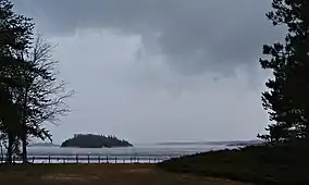 Storm over Ivanhoe Lake PP | |
 Location of Ivanhoe Lake Provincial Park in Ontario | |
| Location | Sudbury, Northeastern Ontario, Ontario, Canada |
| Coordinates | 48°08′57″N 82°30′43″W |
| Area | 1,589 ha (6.14 sq mi) |
| Elevation | 354 m (1,161 ft) |
| Website | www |
Facilities
The park has play areas adjacent to a sandy wading and swimming beach. It also has 120 camp sites of which 64 have electrical hookup, and offers showers, flush toilets, a store, canoe rental, and a boat launch.[3]
Natural history
Ivanhoe Lake Provincial Park has a number of glacial features including eskers, kettle lakes and a kettle lake that has become a quaking bog. It is in the Boreal forest biome and has plant species such as wild rice and six species of orchids.[4]
References
- "Ivanhoe Lake Provincial Park". Geographical Names Data Base. Natural Resources Canada. Retrieved 2011-09-10.
- Map 12 (PDF) (Map). 1 : 1,600,000. Official road map of Ontario. Ministry of Transportation of Ontario. 2010-01-01. Retrieved 2011-09-09.
- "Facilities & Services". Ivanhoe Lake. Ontario Parks. 2002-11-18. Retrieved 2011-09-10.
- "Natural features". Ivanhoe Lake. Ontario Parks. 2002-11-18. Retrieved 2011-09-10.