Ixtlahuacán Municipality
Ixtlahuacán is a municipality in the Mexican state of Colima. The municipal seat lies at Ixtlahuacán. The municipality covers an area of 468.7 km².
Ixtlahuacán | |
|---|---|
 Coat of arms | |
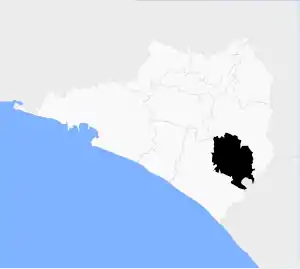 Municipality of Ixtlahuacán in Colima | |
Ixtlahuacán Location in Mexico | |
| Coordinates: 18°59′52″N 103°44′09″W | |
| Country | |
| State | Colima |
| Municipal seat | Ixtlahuacán |
| Area | |
| • Total | 468.7 km2 (181.0 sq mi) |
| Population (2005) | |
| • Total | 2,484 |
As of 2005, the municipality had a total population of 2,484.[1]
Its residents are called Ixtlahuaqueños. It is one of the poorest and most remote municipios of the state. It is located between Tecoman and the city of Colima [2][3]
Climate
| Climate data for Ixtlahuacan | |||||||||||||
|---|---|---|---|---|---|---|---|---|---|---|---|---|---|
| Month | Jan | Feb | Mar | Apr | May | Jun | Jul | Aug | Sep | Oct | Nov | Dec | Year |
| Average high °C (°F) | 33.6 (92.5) |
34 (93) |
34 (93) |
34.3 (93.7) |
34.9 (94.8) |
34.7 (94.5) |
34.5 (94.1) |
34.4 (93.9) |
33.6 (92.5) |
34.1 (93.4) |
34.3 (93.7) |
34 (93) |
34.2 (93.6) |
| Average low °C (°F) | 17.1 (62.8) |
17.0 (62.6) |
17.3 (63.1) |
18.6 (65.5) |
20.6 (69.1) |
22.6 (72.7) |
21.6 (70.9) |
22.3 (72.1) |
22.1 (71.8) |
21.6 (70.9) |
19.8 (67.6) |
18.4 (65.1) |
19.9 (67.8) |
| Average precipitation mm (inches) | 10 (0.4) |
5.1 (0.2) |
5.1 (0.2) |
5.1 (0.2) |
10 (0.4) |
99 (3.9) |
150 (6) |
180 (7) |
200 (7.7) |
89 (3.5) |
10 (0.4) |
13 (0.5) |
770 (30.2) |
| Source: Weatherbase [4] | |||||||||||||
References
- "Ixtlahuacán". Enciclopedia de los Municipios de México. Instituto Nacional para el Federalismo y el Desarrollo Municipal. Archived from the original on September 27, 2007. Retrieved November 9, 2008.
- "Gentilicios Mexicanos". Archived from the original on 2008-09-15. Retrieved 2008-04-20.
- Enciclopedia de México en CD ROM, Dataconsult S.A. de C.V., 1999, Disk 1
- "Weatherbase: Historical Weather for Ixtlahuacan, Colima". Weatherbase. 2011. Retrieved on November 24, 2011.
Colima (capital) | ||
| Municipalities (municipal seats) |  | |
This article is issued from Wikipedia. The text is licensed under Creative Commons - Attribution - Sharealike. Additional terms may apply for the media files.