Jalasjärvi
Jalasjärvi is a former municipality of Finland. It was merged to the town of Kurikka on 1 January 2016.
Jalasjärvi | |
|---|---|
Former municipality | |
| Jalasjärven kunta Jalasjärvi kommun | |
 Coat of arms | |
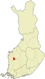 Location of Jalasjärvi in Finland | |
| Coordinates: 62°29.5′N 022°46′E | |
| Country | Finland |
| Region | Southern Ostrobothnia |
| Sub-region | Seinäjoki sub-region |
| Charter | 1867 |
| Consolidated | 2016 |
| Government | |
| • Municipal manager | Juha Luukko |
| Area | |
| • Total | 830.39 km2 (320.62 sq mi) |
| • Land | 818.70 km2 (316.10 sq mi) |
| • Water | 11.69 km2 (4.51 sq mi) |
| Population (2015-06-30)[2] | |
| • Total | 7,834 |
| • Density | 9.4/km2 (24/sq mi) |
| Time zone | UTC+2 (EET) |
| • Summer (DST) | UTC+3 (EEST) |
| Website | www.jalasjarvi.fi |
It is located in the province of Western Finland and is part of the Southern Ostrobothnia region. The population of Jalasjärvi was 7,834 (30 June 2015)[2] and covered a land area of 818.70 km2 (316.10 sq mi).[1] The population density was 9.5688/km2 (24.7832/sq mi).
The municipality was unilingually Finnish.
Villages
Alavalli, Hirvijärvi, Ilvesjoki, Jalasjärvi, Jokipii, Keskikylä, Koskue, Luopajärvi, Sikakylä, Taivalmaa and Ylivalli.
Sights
- The Devil's Nest, the deepest ground erosion in Europe
- The Local Heritage Museum of Jalasjärvi, one of the largest local museums in Finland, consisting of over 25 rural buildings and a collection of exhibits approaching nearly 30,000 items in total
References
- "Area by municipality as of 1 January 2011" (PDF) (in Finnish and Swedish). Land Survey of Finland. Retrieved 9 March 2011.
- "Väestötietojärjestelmä rekisteritilanne 30.06.2015" (in Finnish and Swedish). Population Register Center of Finland. Archived from the original on 3 October 2013. Retrieved 17 July 2015.
External links
 Media related to Jalasjärvi at Wikimedia Commons
- Municipality of Jalasjärvi – Official website
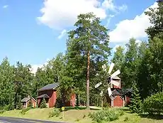
Local heritage museum of Jalasjarvi
| Municipalities |  | |
|---|---|---|
| Former municipalities |
| |
| Authority control |
|---|
This article is issued from Wikipedia. The text is licensed under Creative Commons - Attribution - Sharealike. Additional terms may apply for the media files.