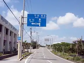
Japan National Route 390
National Route 390 (国道390号, Kokudō Sanbyaku kyu-jū-gō) is both the southernmost and westernmost of the national highways of Japan. It connects Ishigaki, Okinawa on Ishigaki Island, to Miyako-jima, and Naha, Okinawa on Okinawa Island in Japan. Spanning the three islands by ferry, the highway has a total length of 58.2 kilometers (36.2 mi) on land and 552.2 kilometers (343.1 mi) when maritime distance is added.
| ||||
|---|---|---|---|---|
| 国道390号 | ||||
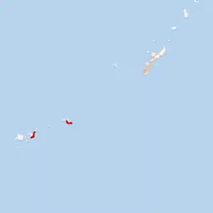
Japan National Route 390 highlighted in red | ||||
 | ||||
| Route information | ||||
| Length | 58.2 km[1] (36.2 mi) | |||
| Highway system | ||||
| National highways of Japan Expressways of Japan
| ||||

Route description
National Route 390 features the 730 Intersection in Ishigaki, a monument to the day when traffic in Okinawa Prefecture was reverted from driving on the right-hand side of the road to the left after the United States relinquished control over the prefecture to Japan following the 1971 Okinawa Reversion Agreement.[2]
See also
 Japan portal
 Roads portal
References
- "一般国道の路線別、都道府県別道路現況" [Road statistics by General National Highway route and prefecture] (PDF) (in Japanese). Ministry of Land, Infrastructure, Transport and Tourism. Retrieved 12 February 2020.
- "Miyara and local children clean and repaint 730 monument". Ryukyu Shimpo. 4 August 2012. Retrieved 7 September 2019.
External links
 Media related to Category:Route 390 (Japan) at Wikimedia Commons
This article is issued from Wikipedia. The text is licensed under Creative Commons - Attribution - Sharealike. Additional terms may apply for the media files.