Japanese Alps
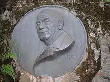
The Japanese Alps (日本アルプス, Nihon Arupusu) is a series of mountain ranges in Japan which bisect the main island of Honshu. The name was coined by English archaeologist William Gowland, and later popularized by Reverend Walter Weston (1861–1940), an English missionary for whom a memorial plaque is located at Kamikōchi, a tourist destination known for its alpine climate. When Gowland coined the phrase, he was only referring to the Hida Mountains, but it now also applies to the Kiso Mountains and Akaishi Mountains.[2]
| Japanese Alps | |
|---|---|
 From the front, South, Central, North Alps | |
| Highest point | |
| Peak | Mount Kita [1] |
| Elevation | 3,193 m (10,476 ft) |
| Coordinates | 35°40′27″N 138°14′12″E |
| Dimensions | |
| Length | 200 km (120 mi) |
| Width | 40 km (25 mi) |
| Naming | |
| Native name | Japanese: 日本アルプス, romanized: Nihon Arupusu |
| Geography | |
 Japanese Alps Japan | |
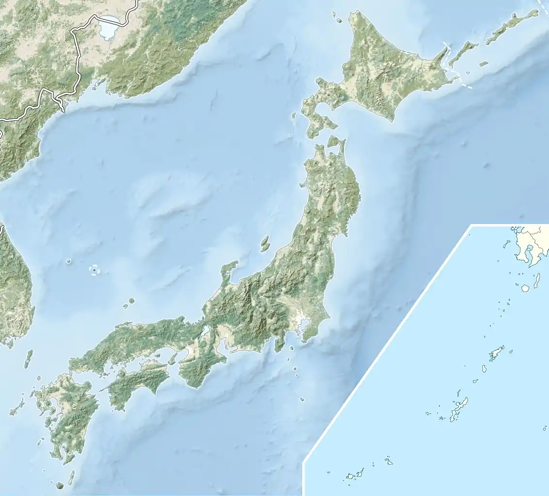
| Location | Niigata Prefecture, Toyama Prefecture, Yamanashi Prefecture, Nagano Prefecture, Gifu Prefecture, Shizuoka Prefecture |
| Country | Japan |
History
The Japanese Alps has a long history before William Gowland established this name. During the 1600s, people tried to discover the river valleys and to map road networks. However, the ridges had never been known and studied. As Kojima Usui later recalled, “in those days,... no one knew even the names of the mountains, much less their locations or elevations. To go mountaineering was literally to strike out into the unknown country.”[3] The first geological survey sheets were issued in 1890. The report mentioned major peaks, but the topography was mostly guesswork. After 1891, Travelers were able to find useful information in Basil Hall Chamberlain and W.B. Mason’s Handbook, but the information was written in English. However, for decades, the Japanese were climbing these mountains without a comparable guidebook. People did physical exploration over a decade in the 1890s. They divided the mountains into (north, central, and south) depending on how they were conventionally grouped. William Gowland, an English geologist, first thought of this swath of terrain as forming a single coherent landscape, comparable to the European Alps. Gowland's view was further developed by another Englishman and Christian missionary, Walter Weston, who was able “to canonize Gowland's geographical conception, deploying it as a de facto proper noun” [4]
William Gowland explored several parts of the ranges in the 1860s, being the first documented foreigner to climb two of the highest peaks in the Alps, Yarigatake and Norikura. Gowland was an archaeologist, and he explored these ranges for archaeological reasons. While William Gowland was the first to explore the ranges, Reverend Walter Weston, a Christian missionary, was the first to document his experiences. Gowland was better known for his work as an archaeologist, and he was an archaeologist before an explorer. About twenty years after Gowland's explorations, Weston explored the ranges himself with Gowland's notes on his explorations.[5]
Weston not only explored the same ranges that Gowland previously traversed, but also ascended the O Renge, Jonendake, Kasadake, Hodakayama, and other minor mountains. Weston first documented the two main mountain systems distinguishable by geological structure. The first of these he called the "China system" due to its connection with southeast China from just south of the Japanese archipelago. The second was called the "Karafuto system", due to the fact that it enters Japan from Karafuto to the north and runs southwest. These two were considered to be the first western explorers of the range, and as a result Weston, with the help of Gowland, popularized and documented different parts of the ranges in an incredibly in-depth manner for others to expand on.[5]
The Japanese Alps are the largest nonvolcanic mountains located in Central Honshu Island. The volcanic peaks that tower over central Honshu have long been the object of veneration and pilgrimage. A leading proponent of mountain climbing in Japan would refer a decade later to "the majestically towering range that forms the Shinano-Hida border" as "the so-called 'Japanese Alps.[6] Shinano's mountains had long been exploited for raw materials, including timber, fuel, fertilizer, fodder, meat, minerals, and medicines. Most visitors came to the mountain for pilgrimage, especially to the Buddhist temple and the sacred peak of Mount Ontake.
Ranges
Today, the Japanese Alps encompass the Hida Mountains (飛騨山脈), the Kiso Mountains (木曽山脈) and the Akaishi Mountains (赤石山脈). These towering ranges include several peaks exceeding 3,000 m (9,843 ft) in height, the tallest after Mount Fuji. The highest are Mount Hotaka at 3,190 m (10,466 ft) in north area and Mount Kita at 3,193 m (10,476 ft) in south area. Mount Ontake is well known as an active volcano, having erupted most recently in 2014.
Northern Alps
The Northern Alps, also known as the Hida Mountains, stretch through Nagano, Toyama and Gifu prefectures. A small portion of the mountains also reach into Niigata Prefecture. It includes the mountains Mount Ontake, Mount Norikura, Mount Yake, Kasumizawadake (霞沢岳), Mount Hotakadake, Mount Yari, Mount Jōnen, Washibadake (鷲羽岳), Suishodake (水晶岳), Nakedake (餓鬼岳), Mount Tate, Kashima Yarigatake (鹿島槍ヶ岳), Goryū dake (五竜岳), Mount Shirouma.
Central Alps
The Central Alps, also known as the Kiso Mountains, are located in the Nagano prefecture. It includes the mountains Mount Ena, Anpaiji mountain (安平路山), Mount Kusumoyama (越百山), Mount Minamikoma, Mount Utsugi, Mount Hōken, Mount Kisokoma, Kyogatake (経ヶ岳).
Southern Alps
The Southern Alps, also known as the Akaishi Mountains, span Nagano, Yamanashi, and Shizuoka prefectures. It includes the mountains Mount Hōō, Mount Nōtori, Mount Aino, Mount Kita, Mount Kaikoma, Mount Senjō, Mount Nokogiri (Akaishi).

Glaciers
Geographers previously believed that no active glaciers existed in Japan, but the Society of Snow and Ice in Tokyo found this to be false in May 2012. By studying surface flow velocity and snow patches in Mount Tsurugi, they found that certain perennial snow patches have large masses of ice, upwards of 30 meters in thickness. This causes these snow patches to be classified as active glaciers, and as of today there are three active glaciers in the Japanese Alps, and all of Japan.[7]
See also
References
- Geographical Survey Institute map 25000:1 仙丈ヶ岳 accessed online 8 April 2008.
- https://www.britannica.com/place/Japanese-Alps
- http://muse.jhu.edu.proxy-um.researchport.umd.edu/article/178069
- http://muse.jhu.edu.proxy-um.researchport.umd.edu/article/178069
- Walter Weston (1896). Mountaineering and Exploration in the Japanese Alps. J. Murray.
- http://muse.jhu.edu.proxy-um.researchport.umd.edu/article/178069
- http://search.ebscohost.com/login.aspx?direct=true&db=geh&AN=2013-003248&site =ehost-live
Further reading
- McCarry, Charles (August 1984). "The Japan Alps". National Geographic. Vol. 166 no. 2. pp. 238–259. ISSN 0027-9358. OCLC 643483454.
External links
| Wikivoyage has a travel guide for Japanese Alps. |
- Japan Alps 7 Cities Tourism
 Media related to Japanese Alps at Wikimedia Commons
| Authority control |
|---|