Jhulaghat
Jhulaghat is a village on the India border, 36 kilometers far from Pithoragarh. Both sides of the towns are called Julaghat. The Kali river flows from East to West along the India Border creating an international boundary. India is connected by a small suspension bridge on the Kali river making an entry point of the people of both country. There is a customs checkpoint for goods.
Jhulaghat | |
|---|---|
village | |
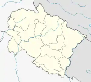 Jhulaghat Location in Uttarakhand, India  Jhulaghat Jhulaghat (India) | |
| Coordinates: 29.571°N 80.375°E | |
| Country | |
| State | Uttarakhand |
| District | Pithoragarh |
| Government | |
| • Body | Gram Panchayet |
| Area | |
| • Total | 3 km2 (1 sq mi) |
| Population | |
| • Total | 1,250 |
| • Density | 420/km2 (1,100/sq mi) |
| Languages | |
| • Official | Hindi |
| Time zone | UTC+5:30 (IST) |
| PIN | 262526 |
| Telephone code | 05964 |
| Vehicle registration | UK |
| Coastline | 0 kilometres (0 mi) |
| Nearest city | Pithoragarh |
| Sex ratio | 985 ♂/♀ |
| Literacy | 95%% |
| Lok Sabha constituency | Almora-Pithoragarh |
| Civic agency | Gram Panchayet |
| Climate | Very Hot during summer and Cold during winter (Köppen) |
| Precipitation | 800 millimetres (31 in) |
| Avg. summer temperature | 48 °C (118 °F) |
| Avg. winter temperature | 4 °C (39 °F) |
| Website | uk |
Jhulaghat Town of Indian side of Pithoragarh district, India. The majority of the population on the Indian side are from Majirkanda Village, a lot of people from Kali Kumaun, Soar Ghati of Uttrakhand are living here. The population of Jhulaghat is slightly more than one thousand. Mahesani Mandir (temple) is one of the attraction point besides Kali river and Nepal border. Chilled Water of Kali river is also attraction and the river Kali is also used for rafting. Musical Ramlila in Jhulaghat is played during the winter for more than 105 Years. The town is good business centre for Indian and Nepali people. Each side's people are attracted to foreign goods available in shops.
Jhulaghat, Nepal
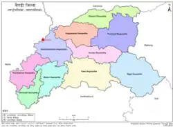
Jhulaghat in Nepal is a part of Dashrathchanda Municipality, which is located in Baitadi District of Sudurpashchim Province. There is a Feeder road F-50 in Jhulaghat, which is connected with Mahakali Highway at Satbanjh, at 37 kilometres (23 mi) of distance. jhulaghat is end point of Mid-Hills Highway of Nepal.[1] There is a suspension bridge at Jhulaghat which connects Jhulaghat, Nepal to Jhulaghat, India.[2]
References
- "Construction of Pushpalal Mid-hill Highway hit". The Himalayan. 10 November 2019. Retrieved 3 February 2021.
- "suspension bridge) Juluaghat, Dasharathchanda, Nepal and Jhulaghat, Uttarakhand, India (Sharda River)". Bridgemeister. Retrieved 3 February 2021.