Jibia
Jibia, (or Jibiya), is a town and Local Government Area (LGA) in Katsina State, northern Nigeria.[1] The population of the LGA was approximately 125,000 as of 2003, and the area is 1037 km².[1]
Jibia | |
|---|---|
LGA and town | |
 Jibia | |
| Coordinates: 13°05′30″N 7°13′35″E | |
| Country | |
| State | Katsina State |
| Area | |
| • Total | 1,037 km2 (400 sq mi) |
| Population (2006 census) | |
| • Total | 169,748 |
| Time zone | UTC+1 (WAT) |
| 3-digit postal code prefix | 822 |
| ISO 3166 code | NG.KT.JI |
The postal code of the area is 822.[2]
Jibia sits along on the Nigerian border with Niger, and the border post was burnt down by a mob in 2005.[3] According to the Daily Triumph newspaper, the mob was "hired" by smugglers angry about the Katsina Custom Command's crackdown on contraband goods.[3] The Local Government shares borders with Batsari, Kaita, Katsina, Batagarawa and Zurmi (Zamfara State) Local Government Areas. Médecins Sans Frontières (Doctors Without Borders) has never operated in Jibia, it operates in some neighboring villages of maradi in Niger republic.
History
Na'im sanusi jibia, a researcher on the history of Jibia, wrote that the origins of Jibia date back to the wars of conquest between the rulers of katsina Emirate, with Maradi and Katsina migrations over territoriality and religion, especially after the jihad of Usman Bin Fodiyo.
References
- "Jibia". nigeriacongress.org. Retrieved 2007-02-10.
- "Post Offices- with map of LGA". NIPOST. Archived from the original on 2009-10-07. Retrieved 2009-10-20.
- Yunusa, Abdulkadir. "Katsina custom command: So far so good". Daily Triumph. Triumph Publishing Company. Retrieved 2007-02-10.
State capital: Katsina | ||
| Local Government Areas | 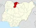 | |
