Jonesville, Michigan
Jonesville is a city in Hillsdale County in the U.S. state of Michigan. The population was 2,258 at the 2010 census.
Jonesville, Michigan | |
|---|---|
| City of Jonesville | |
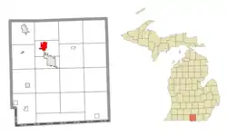 Location within Hillsdale County | |
 Jonesville Location within the state of Michigan | |
| Coordinates: 41°58′52″N 84°39′59″W | |
| Country | United States |
| State | Michigan |
| County | Hillsdale |
| Founded | 1828 |
| Incorporated | 2014 |
| Government | |
| • Type | Council–manager |
| • Mayor | Gerald Arno |
| • Clerk | Cindy Means |
| • Manager | Jeffrey Gray |
| Area | |
| • Total | 2.83 sq mi (7.32 km2) |
| • Land | 2.79 sq mi (7.23 km2) |
| • Water | 0.03 sq mi (0.08 km2) |
| Elevation | 1,076 ft (328 m) |
| Population | |
| • Total | 2,258 |
| • Estimate (2019)[3] | 2,215 |
| • Density | 793.05/sq mi (306.17/km2) |
| Time zone | UTC-5 (Eastern (EST)) |
| • Summer (DST) | UTC-4 (EDT) |
| ZIP code(s) | 49250 |
| Area code(s) | 517 |
| FIPS code | 26-41920[4] |
| GNIS feature ID | 0629385[5] |
| Website | Official website |
History
The village was founded in 1828 at a stop along the famous Sauk Trail, otherwise known as the Chicago Road (now US12), where it intersects highway M-99.
In August 2014, the village voted to adopt a charter and incorporate as a city.[6]
Geography
According to the United States Census Bureau, the village has a total area of 2.92 square miles (7.56 km2), of which 2.89 square miles (7.49 km2) is land and 0.03 square miles (0.08 km2) is water.[7]
Demographics
| Historical population | |||
|---|---|---|---|
| Census | Pop. | %± | |
| 1850 | 565 | — | |
| 1860 | 1,008 | 78.4% | |
| 1880 | 1,445 | — | |
| 1890 | 1,288 | −10.9% | |
| 1900 | 1,307 | 1.5% | |
| 1910 | 1,396 | 6.8% | |
| 1920 | 1,274 | −8.7% | |
| 1930 | 1,316 | 3.3% | |
| 1940 | 1,302 | −1.1% | |
| 1950 | 1,594 | 22.4% | |
| 1960 | 1,896 | 18.9% | |
| 1970 | 2,081 | 9.8% | |
| 1980 | 2,172 | 4.4% | |
| 1990 | 2,283 | 5.1% | |
| 2000 | 2,337 | 2.4% | |
| 2010 | 2,258 | −3.4% | |
| 2019 (est.) | 2,215 | [3] | −1.9% |
| U.S. Decennial Census[8] | |||
2010 census
As of the census[2] of 2010, there were 2,258 people, 894 households, and 596 families living in the village. The population density was 781.3 inhabitants per square mile (301.7/km2). There were 983 housing units at an average density of 340.1 per square mile (131.3/km2). The racial makeup of the village was 95.3% White, 2.1% African American, 0.3% Native American, 0.9% Asian, 0.3% from other races, and 1.1% from two or more races. Hispanic or Latino of any race were 2.1% of the population.
There were 894 households, of which 30.1% had children under the age of 18 living with them, 48.2% were married couples living together, 13.4% had a female householder with no husband present, 5.0% had a male householder with no wife present, and 33.3% were non-families. 29.1% of all households were made up of individuals, and 14.8% had someone living alone who was 65 years of age or older. The average household size was 2.41 and the average family size was 2.95.
The median age in the village was 37.6 years. 26.3% of residents were under the age of 18; 9.2% were between the ages of 18 and 24; 23.3% were from 25 to 44; 23.8% were from 45 to 64; and 17.4% were 65 years of age or older. The gender makeup of the village was 47.4% male and 52.6% female.
2000 census
As of the census[4] of 2000, there were 2,337 people, 926 households, and 623 families living in the village. The population density was 856.7 per square mile (330.5/km2). There were 975 housing units at an average density of 357.4 per square mile (137.9/km2). The racial makeup of the village was 96.02% White, 1.93% African American, 0.26% Native American, 0.21% Asian, 0.39% from other races, and 1.20% from two or more races. Hispanic or Latino of any race were 1.80% of the population.
There were 926 households, out of which 31.0% had children under the age of 18 living with them, 54.1% were married couples living together, 10.0% had a female householder with no husband present, and 32.7% were non-families. 28.9% of all households were made up of individuals, and 13.2% had someone living alone who was 65 years of age or older. The average household size was 2.39 and the average family size was 2.92.
In the village, the population was spread out, with 27.9% under the age of 18, 8.0% from 18 to 24, 26.4% from 25 to 44, 22.4% from 45 to 64, and 15.2% who were 65 years of age or older. The median age was 36 years. For every 100 females, there were 102.0 males. For every 100 females age 18 and over, there were 93.8 males.
The median income for a household in the village was $35,223, and the median income for a family was $41,813. Males had a median income of $34,135 versus $23,333 for females. The per capita income for the village was $15,877. About 6.5% of families and 9.9% of the population were below the poverty line, including 9.5% of those under age 18 and 5.8% of those age 65 or over.
References
- "2019 U.S. Gazetteer Files". United States Census Bureau. Retrieved July 25, 2020.
- "U.S. Census website". United States Census Bureau. Retrieved 2012-11-25.
- "Population and Housing Unit Estimates". United States Census Bureau. May 24, 2020. Retrieved May 27, 2020.
- "U.S. Census website". United States Census Bureau. Retrieved 2008-01-31.
- "US Board on Geographic Names". United States Geological Survey. 2007-10-25. Retrieved 2008-01-31.
- Maneval, Matthew (7 August 2014). "City Charter approved by voters". Hillsdale Daily News. Retrieved 2 December 2014.
- "US Gazetteer files 2010". United States Census Bureau. Archived from the original on 2012-07-02. Retrieved 2012-11-25.
- "Census of Population and Housing". Census.gov. Retrieved June 4, 2015.
External links
Municipalities and communities of Hillsdale County, Michigan, United States | ||
|---|---|---|
| Cities | 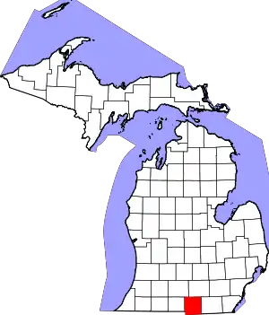 Map of Michigan highlighting Hillsdale County.svg | |
| Villages | ||
| Civil townships | ||
| Unincorporated communities | ||
| ||