Juliaetta, Idaho
Juliaetta is a city in Latah County, Idaho, United States.[5] The population was 579 at the 2010 census.
Juliaetta | |
|---|---|
Town | |
Seal | |
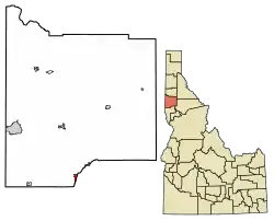 Location of Juliaetta in Latah County, Idaho. | |
| Coordinates: 46°34′44″N 116°42′22″W | |
| Country | United States |
| State | Idaho |
| County | Latah |
| Settled | 1878 |
| Incorporated (town) | April 19, 1892 |
| Area | |
| • Total | 0.71 sq mi (1.84 km2) |
| • Land | 0.70 sq mi (1.81 km2) |
| • Water | 0.01 sq mi (0.03 km2) |
| Elevation | 1,171 ft (357 m) |
| Population | |
| • Total | 579 |
| • Estimate (2019)[4] | 601 |
| • Density | 861.03/sq mi (332.53/km2) |
| Time zone | UTC-8 (Pacific (PST)) |
| • Summer (DST) | UTC-7 (PDT) |
| ZIP Code | 83535 |
| Area code(s) | 208 |
| FIPS code | 16-42130 |
| GNIS feature ID | 399940[5] |
| Website | www |
History
.jpg.webp)
The area was originally called Schupferville for Rupert Schupfer, an original homesteader in the area.[6] The town was named in 1882 by the first postmaster, Charles Snyder. He named the town in honor of his two daughters, Julia and Etta.[7] The city was incorporated in 1892 when the railroad was extended to that point.[8]
The Bank of Juliaetta is a historic building located on Main Street. It was built in 1889 and now houses a restaurant. The building was placed on the historic register in 1998.[9]
Geography
Juliaetta is approximately 2 mi (3.2 km) north of the Nez Perce Indian Reservation; the Potlatch River runs parallel to Highway 3.
According to the United States Census Bureau, the city has a total area of 0.73 square miles (1.89 km2), of which, 0.72 square miles (1.86 km2) is land and 0.01 square miles (0.03 km2) is water.[10]
Demographics
| Historical population | |||
|---|---|---|---|
| Census | Pop. | %± | |
| 1900 | 287 | — | |
| 1910 | 414 | 44.3% | |
| 1920 | 427 | 3.1% | |
| 1930 | 274 | −35.8% | |
| 1940 | 337 | 23.0% | |
| 1950 | 365 | 8.3% | |
| 1960 | 368 | 0.8% | |
| 1970 | 423 | 14.9% | |
| 1980 | 522 | 23.4% | |
| 1990 | 488 | −6.5% | |
| 2000 | 609 | 24.8% | |
| 2010 | 579 | −4.9% | |
| 2019 (est.) | 601 | [4] | 3.8% |
| U.S. Decennial Census[11] | |||
_roads.PNG.webp)
2010 census
As of the census[3] of 2010, there were 579 people, 263 households, and 163 families residing in the city. The population density was 804.2 inhabitants per square mile (310.5/km2). There were 294 housing units at an average density of 408.3 per square mile (157.6/km2). The racial makeup of the city was 95.7% White, 0.2% African American, 1.7% Native American, and 2.4% from two or more races. Hispanic or Latino of any race were 1.4% of the population.
There were 263 households, of which 23.6% had children under the age of 18 living with them, 47.5% were married couples living together, 9.5% had a female householder with no husband present, 4.9% had a male householder with no wife present, and 38.0% were non-families. 31.2% of all households were made up of individuals, and 12.9% had someone living alone who was 65 years of age or older. The average household size was 2.20 and the average family size was 2.72.
The median age in the city was 46.8 years. 18.7% of residents were under the age of 18; 6.8% were between the ages of 18 and 24; 22.3% were from 25 to 44; 31.5% were from 45 to 64; and 20.9% were 65 years of age or older. The gender makeup of the city was 49.2% male and 50.8% female.
2000 census
As of the census[12] of 2000, there were 609 people, 255 households, and 175 families residing in the city. The population density was 856.1 people per square mile (331.2/km2). There were 275 housing units at an average density of 386.6 per square mile (149.5/km2). The racial makeup of the city was 96.72% White, 2.13% Native American, 0.16% Asian, and 0.99% from two or more races. Hispanic or Latino of any race were 0.82% of the population.
There were 255 households, out of which 25.5% had children under the age of 18 living with them, 56.5% were married couples living together, 9.8% had a female householder with no husband present, and 31.0% were non-families. 27.5% of all households were made up of individuals, and 14.5% had someone living alone who was 65 years of age or older. The average household size was 2.39 and the average family size was 2.89.
In the city, the population was spread out, with 24.1% under the age of 18, 7.7% from 18 to 24, 22.8% from 25 to 44, 28.1% from 45 to 64, and 17.2% who were 65 years of age or older. The median age was 41 years. For every 100 females, there were 106.4 males. For every 100 females age 18 and over, there were 101.7 males.
The median income for a household in the city was $33,295, and the median income for a family was $39,250. Males had a median income of $31,875 versus $18,594 for females. The per capita income for the city was $14,606. About 4.2% of families and 12.3% of the population were below the poverty line, including 16.7% of those under age 18 and 5.7% of those age 65 or over.
References
- "2019 U.S. Gazetteer Files". United States Census Bureau. Retrieved July 9, 2020.
- "Geographic Names Information System". U.S. Geological Survey. U.S. Department of the Interior. 1979. Retrieved 2007-05-10.
- "U.S. Census website". United States Census Bureau. Retrieved 2012-12-18.
- "Population and Housing Unit Estimates". United States Census Bureau. May 24, 2020. Retrieved May 27, 2020.
- U.S. Geological Survey Geographic Names Information System: Juliaetta
- Boone, Lalia (1988). Idaho Place Names, A Geographical Dictionary. Moscow, Idaho: University of Idaho Press. ISBN 0-89301-119-3.
- Otness, Lillian Woodworth (1983). A Great good country: a guide to historic Moscow and Latah County, Idaho. Moscow, ID: Latah County Historical Society. p. 156. ISBN 0-914429-10-8.
- "Juliaetta was garden spot of Potlatch River valley". Moscow-Pullman Daily News. 13 May 1988. p. 9. Retrieved 28 January 2018.
- "National Register Information System". National Register of Historic Places. National Park Service. July 9, 2010.
- "US Gazetteer files 2010". United States Census Bureau. Archived from the original on 2012-07-02. Retrieved 2012-12-18.
- "Census of Population and Housing". Census.gov. Retrieved June 4, 2015.
- "U.S. Census website". United States Census Bureau. Retrieved 2008-01-31.
External links
Municipalities and communities of Latah County, Idaho, United States | ||
|---|---|---|
| Cities | Map of Idaho highlighting Latah County | |
| CDP | ||
| Unincorporated communities | ||
| ||
| Authority control |
|---|