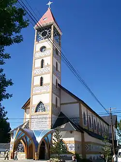
Junín de los Andes
Junín de los Andes is a village in the province of Neuquén, Argentina. It has 10,592 inhabitants at the 2001 census [INDEC], and is the head town of the Huiliches Department. It is located in the south of the province, by the Chimehuin River, on National Route 234, about 35 km (22 mi) north of San Martín de los Andes and 17 km (11 mi) from the Chapelco Airport, which services the area. In spring and summer, it's a famous place for birdwatching, fishing and also climbing the nearest volcano called Lanin.
Junín de los Andes | |
|---|---|
 Junín de Los Andes | |
 Junín de los Andes 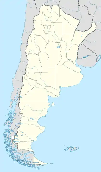 Junín de los Andes | |
| Coordinates: 39°55′S 71°04′W | |
| Country | |
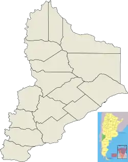
| Province | Neuquén |
| Department | Huiliches |
| Founded | February 15, 1883 |
| Government | |
| • Mayor | Rubén Enrique Campos |
| Elevation | 902 m (2,959 ft) |
| Population | |
| • Total | 10,302 |
| CPA Base | Q 8371 |
| Area code(s) | +54 02972 |
| Climate | Csb |
| Website | www.junindelosandes.gov.ar |
History
The area of the Huiliches Department was populated in the pre-hispanic times. Prior to the expansion of the Argentine state into Patagonia at the end of the 19th century, the Mapuche and Tehuelche hunting and gathering tribes coexisted in the region.[1][2]
In 1882, the Argentine Army first reached the near area of the current village after heavy fighting with the natives. A fortress was erected to secure the position. Commander Senior Sergeant Miguel E. Vidal was said to have picked the location of the fortress and is considered the founder of the village. The next year an expedition was carried out from there to the valley of the Chimehuin river to found the settlement. The military authorities originally wanted to name it General Frías, but ultimately changed it to Junín de los Andes, inspired by the Aymara vocalbe hunins, meaning pasture.[3]
During the initial years, the settlement worked rather as a military outpost. Salesian priests Domingo Melanesio and Juán Ruggerone arrived in 1892. They worked evangelizing the natives and contributed opening the Salesian house with two schools for the children. Over the next years, the settlement developed into a cattle town with the influx of newly arrived pinoneers. It was designed in a grid plan with a central square and country houses distributed across its wide streets. Some of the first buldings were built during these years: the original parish church in 1893, then demolished in 1925 due to poor building conditions, the post office opened in 1900.[4] The first developing committee of the Huiliches Department was formed in 1924. The town was declared a municipality by national decree Nº 17.425 in 1945.[3]
Geography
Junín de los Andes lies on the left bank of the Chimehuín river, in a depression in the northern Patagonian Andes.[4]"Estudio geocientífico aplicado al ordenamiento territorial, Junín de los Andes, Provincia del Neuquén". Argentina's Geological Mining Service (in Spanish). Retrieved February 7, 2021.</ref>
The surrounding nature is divided into three landscape zones: the east, characterized by plateau basalt with its fluvial valleys, formed by wind erosion, where mountains and small hills are seen; the center, which is a valley glacier area with rivers and creeks and their mallín-vegetated banks; and the west, where the volcanoes such as the Lanín (3,776 metres (12,388 ft) above sea level) and lakes prevail.[5]
There is a prominent network of bodies of water near town, including glacial lakes Huechulafquen, Epulafquén and Tromén. They are complemented by rivers, such as Aluminé, Quilquihue and Malleo.[6]
References
- Municipal information: Municipal Affairs Federal Institute (IFAM), Municipal Affairs Secretariat, Ministry of Interior, Argentina. (in Spanish)
- "Junín de los Andes. Historias y leyendas". InterPatagonia (in Spanish). Retrieved February 6, 2021.
- "137 años de Junín de los Andes, el pueblo ubicado en el paraíso". El Andino (in Spanish). February 15, 2020. Retrieved February 7, 2021.
- "Archivo Histórico". Junín de los Andes' Official Website (in Spanish). Retrieved February 6, 2021.
- "Recorrido histórico en Junín de los Andes". Argentina's Official Touristic Website (in Spanish). Retrieved February 7, 2021.
- "Plan estratégico de desarrollo territorial de Junín de los Andes, Provincia del Neuquén. 1er Informe Parcial" (PDF). Argentine Ministry of the Interior (in Spanish). 2006. Retrieved February 7, 2021.
- "Junín de los Andes: Punto de partida a paisajes espectaculares". Patagonia.com.ar (in Spanish). Retrieved February 7, 2021.