San Martín de los Andes
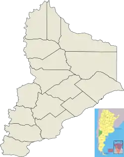
San Martín de los Andes is a city in the province of Neuquén, Argentina. It is located in the Lácar Department in the south-west of the province, at the foot of the Andes.
San Martín de los Andes | |
|---|---|
 View of the city's coast facing the Lácar Lake | |
 San Martín de los Andes  San Martín de los Andes | |
| Coordinates: 40°10′S 071°21′W | |
| Country | |
| Province | |
| Department | Lácar |
| Government | |
| • Mayor | Carlos Saloniti[1] (MPN) |
| Area | |
| • Total | 140 km2 (50 sq mi) |
| Elevation | 640 m (2,100 ft) |
| Population | |
| • Total | 23,519 |
| • Density | 170/km2 (440/sq mi) |
| Time zone | UTC-3 (ART) |
| CPA base | Q8370 |
| Dialing code | +54 2972 |
| Climate | Csb |
History
Before the founding of San Martín de los Andes, the valley of Chapelco was sparsely populated by indigenous Puelches who used it as a refuge during the harsh winters of the zone. The Puelches had, since colonial times, engaged in trade with the Huilliches on the eastern slope of the Andes through various mountain passes. Puelches raised horses on the eastern slopes of the Andes and traded them for weapons and alcoholic beverages becoming one of the main food providers of the isolated exclave of Valdivia. The Argentine and Chilean military campaigns; the conquest of the Desert and the occupation of Araucanía; in the second half of the 19th century bought a definitive end to this trade.
German settlers began to arrive in neighboring southern Chile from the 1840s. Some of these settlers and their descendants began a lucrative leather industry obtaining leather from indigenous communities across the Andes.[2] In the 1880s the Argentine Army displaced indigenous communities disrupting this trade forcing leather merchants in Chile themselves to cross the Andes to obtain supplies. This way numerous entrepreneurs from Chile, many with a German background, established cattle and trade business in the area of Lácar and Nahuel Huapi lakes.[2]
In 1898 a military expedition arrived in the area to take control of the zone due to increasing border disputes with Chile. The Boundary treaty of 1881 between Chile and Argentina led to disputes whether the main Andean Mountain Range or the continental divide should serve as border in this latitude. Chilean authorities argued that since Lácar Lake drained into the Pacific the area of San Martín should belong to Chile. The Argentine government was also concerned about the zone's dependence on trade with Chile, just like in Bariloche and other parts of the southern Andes. San Martín de los Andes, modeled like a European style alpine village, was founded on 4 February 1898. Following the founding, the main economic activities were wood logging and husbandry.
A major change in settlement life came when in 1937 Lanín National Park was created. This meant that wood logging was gradually reduced and numerous small settlements along the lake shore disappeared. New roads were built effectively connecting San Martín with the rest of Argentina. This led to an increased trade that almost ended local husbandry and agriculture. In the 1970s with the help of bank credits many tourism enterprises were established in San Martín making the town up to this day an important tourism center, specially during winter when the ski pistes are open.
Tourism
San Martín de los Andes is a tourist destination in both summer and winter, and is the seat of the administration headquarters of the Lanín National Park. The South American Bird Fair, the main birding meeting in the continent, takes place in the town. Chapelco is a ski centre in Argentina and South America for winter sports like skiing and snowboarding amongst others.
The town is served by the Aviador Carlos Campos Airport, which is 22 km (14 mi) away from the centre. Hua-Hum international pass, which leads to Panguipulli in Chile, lies 45 km (28 mi) from San Martín de los Andes. Once the border is crossed into Chile, a ferry across Lake Pirihueico enables travelers to cover the distance from Puerto Pirihueico to Puerto Fuy, as there are no roads in this area.
Geography
Geology
The city lies in an area of varied geology. Rocks in the area include metamorphic, plutonic and volcanic rocks. Metamorphic rocks found are schists, gneisses and migmatites, all of whom have sedimentary protoliths. Deposition of sediments occurred no earlier than in the Cambrian period and metamorphism occurred during the Devonian period as part of the Famatinian orogeny.[3] Plutonic rocks around San Martín de los Andes crystallized from magma in the Devonian in connection to the onset of the Gondwanide orogeny. Plutonic rock types in the area are granodiorites, tonalites and less voluminous gabbros.[3] Plutonic and metamorphic rocks make up the basement around San Martín de Los Andes,[3] yet near Cerro Chapelco this basement is overlain by volcaniclastic and sedimentary rock belonging to Huitre Formation.[4] The higher parts of Cerro Chapelco are made up of basaltic and andesitic lavas of Chapelco Formation which overlies Huitre Formation. These lavas erupted and cooled into rock about 4 million years ago in the Pliocene Epoch.[4]
Climate
San Martín de los Andes has a cool ocean-influenced climate, on the boundary between Mediterranean (Köppen Csb), and oceanic (Cfb). Being shielded somewhat by the Andes in Chile, it is much less wet and more sunny than Chilean Patagonia, but still is very susceptible to heavy storms during the winter which tend to produce a mixture of rain and snow when they manage to retain some moisture over the Andean divide. However, when it is not raining or snowing heavily, the weather can be extremely sunny and beautiful, though the nights under these conditions are chilly and frost has occurred even during the summer.
| Climate data for San Martín de los Andes (1993–2004) | |||||||||||||
|---|---|---|---|---|---|---|---|---|---|---|---|---|---|
| Month | Jan | Feb | Mar | Apr | May | Jun | Jul | Aug | Sep | Oct | Nov | Dec | Year |
| Record high °C (°F) | 36.8 (98.2) |
34.7 (94.5) |
36.9 (98.4) |
26.6 (79.9) |
22.1 (71.8) |
16.7 (62.1) |
16.3 (61.3) |
21.3 (70.3) |
24.7 (76.5) |
28.4 (83.1) |
30.8 (87.4) |
33.5 (92.3) |
36.9 (98.4) |
| Average high °C (°F) | 21.9 (71.4) |
19.9 (67.8) |
19.5 (67.1) |
15.1 (59.2) |
12.1 (53.8) |
9.4 (48.9) |
9.6 (49.3) |
9.4 (48.9) |
11.8 (53.2) |
14.5 (58.1) |
17.7 (63.9) |
20.4 (68.7) |
15.1 (59.2) |
| Daily mean °C (°F) | 17.1 (62.8) |
15.5 (59.9) |
13.8 (56.8) |
10.3 (50.5) |
7.6 (45.7) |
4.5 (40.1) |
4.9 (40.8) |
5.5 (41.9) |
7.7 (45.9) |
10.2 (50.4) |
12.8 (55.0) |
15.5 (59.9) |
10.4 (50.7) |
| Average low °C (°F) | 11.8 (53.2) |
10.1 (50.2) |
8.8 (47.8) |
6.1 (43.0) |
3.1 (37.6) |
0.0 (32.0) |
0.4 (32.7) |
1.9 (35.4) |
3.4 (38.1) |
5.0 (41.0) |
7.4 (45.3) |
10.0 (50.0) |
5.6 (42.1) |
| Record low °C (°F) | 3.1 (37.6) |
0.1 (32.2) |
−0.4 (31.3) |
−3.5 (25.7) |
−4.5 (23.9) |
−7.1 (19.2) |
−6.1 (21.0) |
−4.8 (23.4) |
−3.6 (25.5) |
−1.3 (29.7) |
0.2 (32.4) |
−0.2 (31.6) |
−7.1 (19.2) |
| Average precipitation mm (inches) | 24.8 (0.98) |
26.7 (1.05) |
51.7 (2.04) |
65.9 (2.59) |
114.8 (4.52) |
262.1 (10.32) |
137.8 (5.43) |
91.9 (3.62) |
86.8 (3.42) |
85.4 (3.36) |
50.6 (1.99) |
21.1 (0.83) |
1,019.4 (40.13) |
| Average precipitation days | 4.9 | 4.3 | 8.0 | 8.8 | 14.0 | 16.9 | 13.6 | 8.9 | 12.0 | 9.4 | 6.9 | 4.5 | 112.0 |
| Source: Instituto Nacional de Tecnología Agropecuaria[5] | |||||||||||||
Sports
Athletic Curruhinca, an amateur soccer team, with the entire squad from San Martin de los Andes, won the title "Copa Cablevision" in December 15 of 2013, becoming the first amateur soccer champion in the big metropolis Buenos Aires originally coming from this city.
References
- "Listado de autoridades municipales - San Martin de los Andes". Municipio de San Martín de los Andes (in Spanish).
- Muñoz Sougarret, Jorge (2014). "Relaciones de dependencia entre trabajadores y empresas chilenas situadas en el extranjero. San Carlos de Bariloche, Argentina (1895-1920)" [Dependence Relationships between Workers and Chilean Companies located abroad. San Car-los de Bariloche, Argentina (1895-1920)]. Trashumante: Revista Americana de Historia Social (in Spanish). 3: 74–95. Retrieved January 3, 2019.
- Serra-Varela, Samanta; Gonzalez, Pablo; Giacosa, Raúl; Heredia, Nemesio; Pedreira, David; Martín-González, Fidel; Sato, Ana (2019). "Evolution of the Palaeozoic basement of the Northpatagonian Andes in the San Martín de los Andes area (Neuquén, Argentina): Petrology, age and correlations". Andean Geology. 46 (1): 102. doi:10.5027/andgeoV46n1-3124.
- Escosteguy, Leonardo; Franchi, Mario (2010). "Estratigrafía de la región de Chapelco, Provincia del Neuquén". Revista de la Asociación Geológica Argentina (in Spanish). 66 (3).
- "Valles neuquinos: Regiones naturales" (in Spanish). Instituto Nacional de Tecnología Agropecuaria. Retrieved October 1, 2017.
- Municipal information: Municipal Affairs Federal Institute (IFAM), Municipal Affairs Secretariat, Ministry of Interior, Argentina. (in Spanish)
- Municipality of San Martín de los Andes - Official website.
- https://web.archive.org/web/20140107093859/http://www.copacablevision.com.ar/index.php?option=com_wrapper&view=wrapper&Itemid=89
External links
 Media related to San Martín de los Andes at Wikimedia Commons
- Official site of the municipality of San Martín de los Andes
- Some information about the San Martin de los Andes in English
| Authority control |
|---|