Juruena River
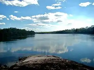
The Juruena River (Portuguese: Rio Juruena) is a 1,240 km (770 mi) long river in west-central Brazil, in the state of Mato Grosso.
| Juruena River | |
|---|---|
 | |
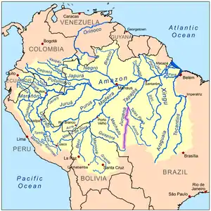 Amazon Basin with the Juruena River highlighted | |
 | |
| Location | |
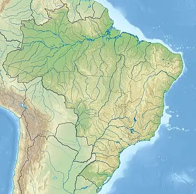
| Country | Brazil |
| Physical characteristics | |
| Source | |
| • location | Parecis plateau, Mato Grosso, Brazil |
| Mouth | Tapajós River |
• location | Amazonas–Mato Grosso border, Brazil |
• coordinates | 7°21′01″S 58°08′18″W |
| Length | 1,240 km (770 mi)[1] |
| Basin features | |
| Tributaries | |
| • left | Vermelho River, Juína-Mirim River, Camararé River, Juína River, Bararati River |
| • right | São Tomé River, São João da Barra River, Arinos River, Do Sangue River, Papagaio River |
Course
The Juruena originates in the Parecis plateau.[2] Within Mato Grosso the river defines the eastern boundary of the 227,817 hectares (562,950 acres) Igarapés do Juruena State Park, created in 2002.[3] For the last 190 km (120 mi) of its lower part the river becomes the border between the states Mato Grosso and Amazonas.[2] In this section the river forms the boundary between the Sucunduri State Park to the west in Amazonas and the Juruena National Park to the east in Mato Grosso.[4] In the north of this section it forms the boundary between the Bararati Sustainable Development Reserve in Amazonas and the Apiacás Ecological Reserve in Mato Grosso.[5]
The Juruena finally joins the Teles Pires river to form the Tapajós river, which is one of the biggest tributaries to the Amazon River. The Juruena River is not navigable due to its many waterfalls and rapids.[2][1] The river is known for the Salto Augusto Falls.
References
- Ziesler & Ardizzone 1979.
- Encyclopædia Britannica.
- PES Igarapés do Juruena – ISA, Informações gerais (mapa).
- PES do Sucunduri – ISA.
- RDS Bararati – ISA, Informações gerais.
Sources
- "Juruena River". Encyclopædia Britannica. Encyclopædia Britannica Inc. 2015. Retrieved 13 February 2015.
- PES do Sucunduri (in Portuguese), ISA: Instituto Socioambiental, retrieved 10 July 2016
- PES Igarapés do Juruena (in Portuguese), ISA: Instituto Socioambiental, retrieved 11 July 2016
- RDS Bararati (in Portuguese), ISA: Instituto Socioambiental, retrieved 13 October 2016
- Ziesler, R.; Ardizzone, G.D. (1979), "Amazon River System", The Inland waters of Latin America, Food and Agriculture Organization of the United Nations, ISBN 92-5-000780-9, archived from the original on 21 October 2013
External links