Kökar
Kökar (![]() pronunciation) is an island municipality to the south-east of the Åland archipelago, Finland.
pronunciation) is an island municipality to the south-east of the Åland archipelago, Finland.
Kökar | |
|---|---|
Municipality | |
| Kökar kommun | |
 Coat of arms | |
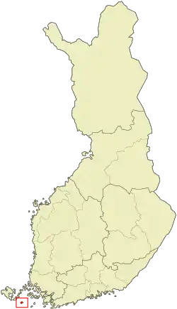 Location of Kökar in Finland | |
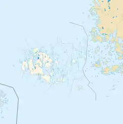 Kökar Location in Åland Islands | |
| Coordinates: 59°55.2′N 020°54.5′E | |
| Country | |
| Region | Åland |
| Sub-region | Archipelago sub-region |
| Government | |
| • Municipal manager | Kurt Forsman |
| Area (2018-01-01)[1] | |
| • Total | 2,165.02 km2 (835.92 sq mi) |
| • Land | 63.55 km2 (24.54 sq mi) |
| • Water | 2,101.46 km2 (811.38 sq mi) |
| Area rank | 305th largest in Finland |
| Population (2020-07-31)[2] | |
| • Total | 222 |
| • Rank | 309th largest in Finland |
| • Density | 3.49/km2 (9.0/sq mi) |
| Population by native language | |
| • Swedish | 91.6% (official) |
| • Finnish | 8% |
| • Others | 0.4% |
| Population by age | |
| • 0 to 14 | 14.9% |
| • 15 to 64 | 60.3% |
| • 65 or older | 24.8% |
| Time zone | UTC+02:00 (EET) |
| • Summer (DST) | UTC+03:00 (EEST) |
| Municipal tax rate[5] | 18.5% |
| Website | www.kokar.ax |
It is also one of the municipalities of Åland. It is reachable by boat from Långnäs on Åland or from Galtby with access to mainland Finland.
The municipality has a population of 222 (31 July 2020)[2] and covers an area of 2,165.02 square kilometres (835.92 sq mi) of which 2,101.46 km2 (811.38 sq mi) is water.[1] The population density is 3.49 inhabitants per square kilometre (9.0/sq mi).
The municipality is unilingually Swedish. The natural reserve of Östra Långskär is located there. Other notable islands include Kyrkogårdsö.
Ulla-Lena Lundberg, a Finnish author, was born in Kökar in 1947.
History
Kökar was first inhabited over 3,000 years ago by seal hunters. A Franciscan monastery was founded in Hamnö in the 15th century. Today the monastery is in ruins. The church dedicated to St. Anne was built in 1784 in the place of the old monastery church.
Sights
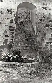
The church of St. Anne was built in the site of the old monastery church during the reign of king Gustav III and is located on the island of Hamnö. It is next to the ruins of the monastery. The clocktower was built in the 19th century. The clocktower had to be restored after an Autumn storm damaged it in 1978. A model of a sailing ship hangs in the church. It was given by a local sailor who had been captured by Turkish pirates but who later managed to escape. The model has 64 cannons.
The local museum was opened in 1988 and its purpose is to show how the people of Kökar lived in the 19th century and onwards to the 1940s. The now museum building, built in 1913, used to be an old school.
There is also a Bronze Age site dating back to 1150–1050 BC. It was found in 1918.
References
- "Area of Finnish Municipalities 1.1.2018" (PDF). National Land Survey of Finland. Retrieved 30 January 2018.
- "Suomen virallinen tilasto (SVT): Väestön ennakkotilasto [verkkojulkaisu]. Heinäkuu 2020" (in Finnish). Statistics Finland. Retrieved 13 September 2020.
- "Population according to language and the number of foreigners and land area km2 by area as of 31 December 2008". Statistics Finland's PX-Web databases. Statistics Finland. Retrieved 29 March 2009.
- "Population according to age and gender by area as of 31 December 2008". Statistics Finland's PX-Web databases. Statistics Finland. Retrieved 28 April 2009.
- "List of municipal and parish tax rates in 2011". Tax Administration of Finland. 29 November 2010. Retrieved 13 March 2011.
External links
![]() Media related to Kökar at Wikimedia Commons
Media related to Kökar at Wikimedia Commons
- Municipality of Kökar – Official website (in Swedish)
- The museum of Kökar's web site
| Authority control |
|
|---|