K-101 (Kansas highway)
K-101 is a ten-mile-long (16 km) state highway entirely within Labette County in the U.S. state of Kansas. K-101's southern terminus is at U.S. Route 166 (US-166) south of the City of Edna and the northern terminus is at US-160 west of the City of Altamont. K-101 passes through mostly rural farmlands except where it passes through Edna.
| ||||
|---|---|---|---|---|
| Delaware Street, Jackson Road | ||||
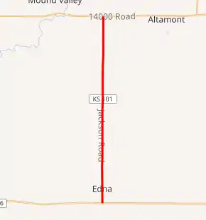
K-101 highlighted in red | ||||
| Route information | ||||
| Maintained by KDOT | ||||
| Length | 9.998 mi[1] (16.090 km) | |||
| Existed | May 26, 1937[2]–present | |||
| Major junctions | ||||
| South end | ||||
| North end | ||||
| Location | ||||
| Counties | Labette | |||
| Highway system | ||||
| ||||

When K-101 was first designated in 1937, it was a 0.55-mile-long (0.89 km) spur linking US-166 to Edna. Then in 1954, it was extended to its current northern terminus, which at the time was K-96. In 1998, the northern terminus became US-160 when K-96 was truncated to end in Wichita.
Route description
K-101 begins at an intersection with US-166 just south of Edna. South of the intersection of US-166, the roadway continues as locally maintained Rural Secondary 369 (RS-369). From US-166, K-101 heads north through Edna and then reaches the Edna Cemetery. Roughly two miles (3.2 km) past Edna Cemetery, it crosses Hackberry Creek, then continues another roughly .5 miles (0.80 km), where it reaches an intersection with RS-378. K-101 continues northward from here for another roughly 3.5 miles (5.6 km), and crosses Pumpkin Creek, a tributary of Pumpkin Creek. Then about 2.5 miles (4.0 km) further north, it reaches the northern terminus at US-160 west of Altamont. Past US-160 the road continues north as locally maintained Jackson Road.[3]
The Kansas Department of Transportation (KDOT) tracks the traffic levels on its highways, and in 2017, they determined that on average the traffic varied from 815 vehicles near the northern terminus to 1630 vehicles near the southern terminus.[4] K-101 is not included in the National Highway System.[5] The National Highway System is a system of highways important to the nation's defense, economy, and mobility. K-101 does connect to the National Highway System at each terminus, US-166 and US-160.[5][6]
History
K-101 was first designated as a state highway on May 26, 1937, as a spur linking US-166 to Edna.[2] Then in a May 10, 1950 resolution, K-101 was extended northward 0.495 miles (0.797 km) to the Edna Cemetery.[7] In a February 24, 1954 resolution, KDOT proposed to extend K-101 northward to at the time K-96 when the county had improved the road to state highway standards. Then by late April the county had made the proper improvements and in a April 28, 1954 resolution, it was extended 8.441 miles (13.584 km) to K-96.[8] On December 3, 1998, K-96 was truncated to end in Wichita and the segment of K-96 that made up the northern terminus of K-101 became US-160.[9]
Major intersections
The entire route is in Labette County.
| Location | mi[1] | km | Destinations | Notes | |
|---|---|---|---|---|---|
| Elm Grove Township | 0.000 | 0.000 | Southern terminus | ||
| Mount Pleasant Township | 9.998 | 16.090 | Northern terminus | ||
| 1.000 mi = 1.609 km; 1.000 km = 0.621 mi | |||||
References
- Staff (2016). "Pavement Management Information System". Topeka: Kansas Department of Transportation. Retrieved April 16, 2017.
- State Highway Commission of Kansas (May 26, 1937). "Resolution establishing a road in Labette County as part of the State Highway System". Topeka: State Highway Commission of Kansas. Retrieved August 21, 2019.
- Bureau of Transportation Planning (2007). Labette County (PDF) (Map). [c. 1:3,900,000]. General Highway Map. Topeka: Kansas Department of Transportation. Retrieved July 29, 2019.
- Bureau of Transportation Planning (2018). Traffic Flow Map Kansas State Highway System (PDF) (Map). [c. 1:1,584,000]. Topeka: Kansas Department of Transportation. Retrieved July 29, 2019.
- Federal Highway Administration (May 8, 2019). National Highway System: Kansas (PDF) (Map). [c. 1:3,900,000]. Washington, DC: Federal Highway Administration. Retrieved July 29, 2019.
- Natzke, Stefan; Neathery, Mike; Adderly, Kevin (September 26, 2012). "What is the National Highway System?". National Highway System. Washington, DC: Federal Highway Administration. Retrieved July 29, 2019.
- State Highway Commission of Kansas (May 10, 1950). "Resolution to extend Highway K-101 in Labette County". Topeka: State Highway Commission of Kansas. Retrieved August 21, 2019.
- State Highway Commission of Kansas (April 28, 1954). "Certification of Completion of County Road in Labette County and officially placing same on State Highway System". Topeka: State Highway Commission of Kansas. Retrieved August 21, 2019.
- Kansas Department of Transportation (December 3, 1998). "Certification of Completion of County Road in Labette County and officially placing same on State Highway System". Topeka: Kansas Department of Transportation. Retrieved August 21, 2019.