K-223 (Kansas highway)
K-223 is a 2.615-mile-long (4.208 km) state highway in the U.S. state of Kansas. K-223's southern terminus is at K-23 south of the community of Leoville, and the northern terminus is at K-383 north of the community of Leoville.
| ||||
|---|---|---|---|---|
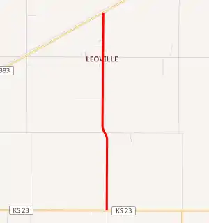
K-223 highlighted in red | ||||
| Route information | ||||
| Maintained by KDOT | ||||
| Length | 2.615 mi[1] (4.208 km) | |||
| Existed | July 30, 1958[2]–present | |||
| Major junctions | ||||
| South end | ||||
| North end | ||||
| Location | ||||
| Counties | Sheridan, Decatur | |||
| Highway system | ||||
| ||||

Route description
K-223 is not included in the National Highway System.[3] The National Highway System is a system of highways important to the nation's defense, economy, and mobility. K-223 does connect to the National Highway System at its junction with K-383.[4] 2017 Annual average daily traffic (AADT) on K-223 was 45 vehicles per day.[5]
History
K-223 was planned by the Kansas Department of Transportation (KDOT) in a July 30, 1958 meeting to become a state highway through Leoville as soon as the roadway was brought up to state highway standards.[2] Then by June 1959, the required projects were complete, and the highway became K-223 in a June 10, 1959 resolution. The alignment of K-223 has not changed since its creation.
Major intersections
| County | Location | mi[1] | km | Destinations | Notes |
|---|---|---|---|---|---|
| Sheridan | Sheridan Township | 0.000 | 0.000 | Southern terminus | |
| Decatur | Dresden Township | 2.615 | 4.208 | Northern terminus | |
| 1.000 mi = 1.609 km; 1.000 km = 0.621 mi | |||||
References
- Staff (2016). "Pavement Management Information System". Kansas Department of Transportation. Retrieved April 16, 2017.
- 1958 Resolution (Map). KDOT. Retrieved July 29, 2019.
- National Highway System: Kansas (PDF) (Map). Federal Highway Administration. Retrieved July 29, 2019.
- Natzke, Stefan; Neathery, Mike; Adderly, Kevin (September 26, 2012). "What is the National Highway System?". National Highway System. Federal Highway Administration. Retrieved July 29, 2019.
- 2017 Traffic Count Map (PDF) (Map). KDOT. Retrieved July 29, 2019.