K-95 (Kansas highway)
K-95 is a 6.591-mile-long (10.607 km) state highway in the U.S. state of Kansas. K-95's southern terminus is at U.S. Route 83 (US-83) north of Scott City, and the northern terminus is at US-83 south of Elkader.[3] K-95 was first designated on July 27, 1966 to connect US-83 to Lake Scott and Lake Scott State Park.[2]
| ||||
|---|---|---|---|---|
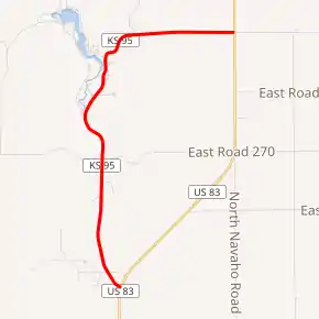
K-95 highlighted in red | ||||
| Route information | ||||
| Maintained by KDOT | ||||
| Length | 6.591 mi[1] (10.607 km) | |||
| Existed | July 27, 1966[2]–present | |||
| Major junctions | ||||
| South end | ||||
| North end | ||||
| Location | ||||
| Counties | Scott | |||
| Highway system | ||||
| ||||

Route description
K-95 is not included in the National Highway System.[4] The National Highway System is a system of highways important to the nation's defense, economy, and mobility. K-95 does connect to the National Highway System at its southern and northern terminus, US-83.[5] 2017 Annual average daily traffic (AADT) on K-95 ranged from 125 near the northern terminus, 275 near Lake Scott State Park and 575 near the southern terminus.[6] The entire route is paved with partial design bituminous pavement.[1][7]
History
K-95 was first approved to become a state highway in a July 27, 1966 resolution to link US-83 to Lake Scott and Lake Scott State Park.[2] This resolution was later rescinded in a May 10, 1967 resolution and a new alignment was approved to become K-95.[8]
Major intersections
The entire route is in Scott County.
| Location | mi[1] | km | Destinations | Notes | |
|---|---|---|---|---|---|
| Michigan Township | 0.000 | 0.000 | Southern terminus | ||
| 3.135 | 5.045 | West Scott Lake Drive – Lake Scott State Park | |||
| 6.591 | 10.607 | Northern terminus | |||
| 1.000 mi = 1.609 km; 1.000 km = 0.621 mi | |||||
References
- Staff (2016). "Pavement Management Information System". Topeka: Kansas Department of Transportation. Retrieved April 16, 2017.
- State Highway Commission of Kansas (July 27, 1966). "Resolution for Location and Designation of Road in Scott County as a State Highway". Topeka: State Highway Commission of Kansas. Retrieved September 4, 2019.
- Bureau of Transportation Planning (November 2009). 2009 Jefferson County (PDF) (Map). [c. 1: 211,200]. General Highway Map. Topeka: Kansas Department of Transportation. Retrieved September 4, 2019.
- Federal Highway Administration (May 8, 2019). National Highway System: Kansas (PDF) (Map). [c. 1:3,900,000]. Washington, DC: Federal Highway Administration. Retrieved July 29, 2019.
- Natzke, Stefan; Neathery, Mike; Adderly, Kevin (September 26, 2012). "What is the National Highway System?". National Highway System. Washington, DC: Federal Highway Administration. Retrieved July 29, 2019.
- Bureau of Transportation Planning (2018). Traffic Flow Map Kansas State Highway System (PDF) (Map). [c. 1:1,584,000]. Topeka: Kansas Department of Transportation. Retrieved July 29, 2019.
- Staff (2012-05-09). "Pavement Management Information System Glossary". Topeka: Kansas Department of Transportation.
- State Highway Commission of Kansas (May 10, 1967). "Revision of Resolution for Location and Designation of Road in Scott County as a State Highway using state-wide funds". Topeka: State Highway Commission of Kansas. Retrieved September 4, 2019.