Kaberamaido
Kaberamaido is a town in Eastern Uganda. It is the main municipal, administrative and commercial center of Kaberamaido District and is the location of the headquarters for the district.
Kaberamaido | |
|---|---|
 Kaberamaido Location in Uganda | |
| Coordinates: 01°46′00″N 33°09′08″E | |
| Country | |
| Region | Eastern Uganda |
| Sub-region | Teso sub-region |
| District | Kaberamaido District |
| Elevation | 3,540 ft (1,080 m) |
| Population (2011 Estimate) | |
| • Total | 3,400 |
Location
Kaberamaido is located approximately 163 kilometres (101 mi) by road, northwest of Mbale, the largest city in Eastern Uganda.[1] This location lies approximately 64 kilometres (40 mi), by road, west of Soroti, the largest town in the sub-region.[2] The coordinates of the town are: Latitude: 1.766667 (1° 46' 00.0"N); Longitude: 33.152221 (33° 09' 08.0"E).[3]
Population
In 2002, the national population census estimated the town's population at about 2,350. In 2010, the Uganda Bureau of Statistics (UBOS), estimated the population of the town at about 3,200. In 2011, UBOS estimated the mid-year population of Kaberamaido at 3,400.[4]
Points of interest
The following points of interest lie within the town limits or near the edges of town:
- The headquarters of Kaberamaido District Administration
- The offices of Kaberamaido Town Council
- Kaberamaido Central Market.
References
- "Road Distance Between Mbale And Kaberamaido With Map". Globefeed.com. Retrieved 31 May 2014.
- "Map Showing Soroti And Kaberamaido With Distance Marker". Globefeed.com. Retrieved 31 May 2014.
- Google (5 July 2015). "Location of Kaberamaido At Google Maps" (Map). Google Maps. Google. Retrieved 5 July 2015.
- UBOS, . "Estimated Population of Kaberamaido In 2002, 2010 & 2011" (PDF). Uganda Bureau of Statistics (UBOS). Archived from the original (PDF) on 7 July 2014. Retrieved 31 May 2014.CS1 maint: numeric names: authors list (link)
External links
Capital: Kaberamaido | ||
| Towns and villages | 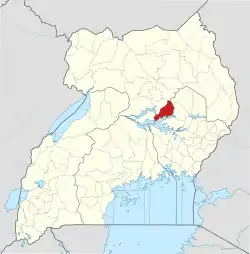 | |
| Education |
| |
| Health | ||
| Notable people | ||