Kahenge Constituency
Kahenge was a constituency in the Kavango Region of Namibia.[1] The district centre was the settlement of Kahenge. It had a population of 29,799 in 2011, down from 30,903 in 2001.[2]
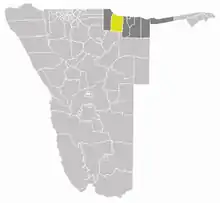
Location of Kahenge constituency (yellow) in the Kavango Region (dark grey)
The constituency contained the Okavango River settlements of Tondoro, Rupara, and Sambusu as well as the inland settlements of Mpanda and Mpuku.
In 2013 the Kavango Region was split into Kavango East and Kavango West. Kahenge Constituency was split into three constituencies. The western part became Tondoro (capital Kahenge), the north-eastern part became Musese (capital Rupara), and the south-eastern part formed the constituency Mankumpi (capital Satotwa).[3]
References
- http://www.ecn.na/regional-profiles1/-/asset_publisher/L6rIcb6zvPhb/content/kavango-west
- "Kavango 2011 Census Regional Profile" (PDF). Statistics Namibia. Retrieved 10 April 2020.
- Nakale, Albertina (9 August 2013). "President divides Kavango into two". New Era. allafrica.com. Archived from the original on 22 October 2014. Retrieved 16 August 2013. Alt URL via allafrica.com
Constituencies in the Kavango West Region of Namibia | ||
|---|---|---|
This article is issued from Wikipedia. The text is licensed under Creative Commons - Attribution - Sharealike. Additional terms may apply for the media files.