Kaloorkot Tehsil
Kallur kot Tehsil (Urdu: تحصِيل كلُوركوٹ), is a Tehsil of Bhakkar District in Punjab, Pakistan. The city of Kallurkot is the headquarters of the Tehsil an administrative subdivision of the district.[1]
تحصِيل كلُوركوٹ
Kallur kot | |
|---|---|
Tehsil | |
| Kallurkot Tehsil | |
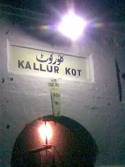 Nameplate of 100 years old Kallur Kot Station under the lamp | |
| Country | Pakistan |
| Region | Punjab |
| District | Bhakkar District |
| Towns | 1 |
| Union Councils | 10 |
| Time zone | UTC+5 (PST) |
Kallurkot Town is a populated place (class P - Populated Place) in Punjab, Pakistan (Asia) with the region font code of Asia/Pacific. It is located at an elevation of 187 meters above sea level and its population amounts to 25,574. KallurKot Town is also known as Kallur Kot Town, Kallur Kot, Kalūr Kot It is located at 31˚37’60N 71˚4’0E at an elevation of 187 metres and lies on the left bank of the Indus river. It has a population of almost 1278000 and was given status of district in 1982.
Administration
The tehsil is administratively subdivided into 10 Union Councils, these are: [2]
|
|
References
- Tehsils & Unions in the District of Bhakkar - Government of Pakistan Archived 2012-02-09 at the Wayback Machine
- "Archived copy". Archived from the original on 2012-02-09. Retrieved 2007-12-22.CS1 maint: archived copy as title (link)
External links
References: