Kamalanagar (Mizoram)
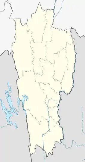
Kamalanagar is a township in Lawngtlai district in the state of Mizoram in India. It is located on the western bank of river Toizung in Tuichawng subdivision and facing the other part of Chawngte township, which is located on the eastern bank but in Lawngtlai subdivision of Lawngtlai district and Lunglei district. It is the headquarters of Chakma Autonomous District Council which covers the Tuichawng subdivision of Lawngtlai district, one of the three autonomous district councils within Mizoram. It is located in the south-western part of the state.
Kamalanagar
Chawngte | |
|---|---|
Village | |
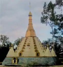 Kamalanagar Buddhist Temple | |
 Kamalanagar  Kamalanagar | |
| Coordinates: 22°37′00″N 92°38′00″E | |
| Country | India |
| State | Mizoram |
| District | Lawngtlai |
| Population (2011) | |
| • Total | 6,328 |
| Languages | |
| • Spoken | Chakma |
| Time zone | UTC+5:30 (IST) |
| PIN | 796772 |
| Vehicle registration | MZ |
| Lok Sabha constituency | Mizoram |
| Vidhan Sabha constituency | Tuichawng |
| Climate | Cwa |
| Website | mizoram cadc |
Villages
Kamalanagar under Chakma Autonomous District Council covers the Kamalanagar - I, Kamalanagar - II, Kamalanagar - III and Kamalanagar - IV villages while Chawngte-P comes under Lawngtlai subdivision which lies in Lai Autonomous District Council and Chawnge-L in Lunglei district.
Demographics
As of 2011 India census, the population of Kamalanagar is 6328, with 1184 Households. There are 3251 males (52%) and 3077 females (49%), with 5997 (95% ) Scheduled Tribes.[1] The population mostly consists of Chakma people who primarily follow Theravada Buddhism.[2]
Education
There is one college Kamalanagar College,[3] under Mizoram University and a number of public and private schools.[4]
Connectivity
It is 92 km west of the district headquarters Lawngtlai, and 317 km from the state capital Aizawl.
References
- "DISTRICT CENSUS HANDBOOK LAWNGTLAI" (PDF). Census of India 2011. Office of the Registrar General.
- "In Mizoram, the BJP depends on the Chakmas to make its debut in the state assembly". Scroll. 2 November 2018.
- "Government Kamalanagar College".
- "Mizoram" (PDF). MoSPI.
External links
- CADC-Chakma Autonomous District Council(CADC)
- CADC at a glance- CADC Headquarters
- Kamalanagar subpost office- Kamalanagar PO
| District Headquarters |  | |
|---|---|---|
| State | ||
| Autonomous District Councils | ||
| Towns and villages |
| |
| Indigenous Tribes | ||
| Peaks |
| |
