Kanwaka Township, Douglas County, Kansas
Kanwaka Township is a township in Douglas County, Kansas, USA. As of the 2000 census, its population was 1,317. The name is a portmanteau of the Kansas River and Wakarusa River.[1]
Kanwaka Township | |
|---|---|
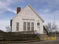 Kanwaka Hall, once the Congregational Church | |
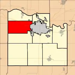 Location in Douglas County | |
| Coordinates: 38°58′00″N 095°24′31″W | |
| Country | United States |
| State | Kansas |
| County | Douglas |
| Area | |
| • Total | 46.99 sq mi (121.71 km2) |
| • Land | 43.85 sq mi (113.57 km2) |
| • Water | 3.14 sq mi (8.14 km2) 6.69% |
| Elevation | 1,030 ft (314 m) |
| Population (2000) | |
| • Total | 1,317 |
| • Density | 30/sq mi (11.6/km2) |
| GNIS feature ID | 0479103 |
Geography
Kanwaka Township covers an area of 46.99 square miles (121.7 km2) and contains no incorporated settlements.
The streams of Coon Creek, Deer Creek and Dry Creek run through this township.
The township contains two cemeteries, Mound and Stull.
Adjacent Townships
- Lecompton Township, Douglas County (north)
- Wakarusa Township, Douglas County (east)
- Clinton Township, Douglas County (south)
- Monmouth Township, Shawnee County (southwest)
- Tecumseh Township, Shawnee County (northwest)
Transportation
Major highways
- I-70, as part of the Kansas Turnpike.
- U.S. Highway 40
- K-10
Towns and Settlements
Although these towns may not be incorporated or populated, they are still placed on maps produced by the county.
- Kanwaka, located at 38°58′19″N 95°22′16″W
- Stull, located at 38°58′16″N 95°27′22″W
Points of interest
- Kanwaka Hall, located along U.S. Highway 40, the building was constructed in 1889 as the Kanwaka Congregational Church.
- Barber School, a one-room schoolhouse now on federal property near Clinton Lake.
References
- "Profile for Kanwaka, Kansas". ePodunk. Retrieved 9 June 2014.
- "Township of Kanwaka". Geographic Names Information System. United States Geological Survey. 13 October 1978. Retrieved 2009-07-15.
External links
Municipalities and communities of Douglas County, Kansas, United States | ||
|---|---|---|
| Cities | 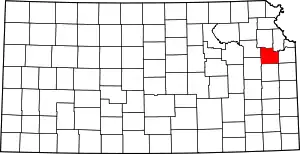 Map of Kansas highlighting Douglas County | |
| Unincorporated communities | ||
| Ghost towns | ||
| Townships | ||
| ||
This article is issued from Wikipedia. The text is licensed under Creative Commons - Attribution - Sharealike. Additional terms may apply for the media files.