Karditsa
Karditsa (Greek: Καρδίτσα, Greek pronunciation: [karˈðit͡sa]) is a city in western Thessaly in mainland Greece. The city of Karditsa is the capital of Karditsa regional unit of region of Thessaly.
Karditsa
Καρδίτσα | |
|---|---|
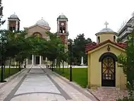
 Street in Karditsa | |
 Karditsa Location within the region  | |
| Coordinates: 39°22′N 21°55′E | |
| Country | Greece |
| Administrative region | Thessaly |
| Regional unit | Karditsa |
| Government | |
| • Mayor | Vasilios Tsiakos (New Democracy (Greece)) |
| Area | |
| • Municipality | 647.4 km2 (250.0 sq mi) |
| • Municipal unit | 110.1 km2 (42.5 sq mi) |
| Elevation | 108 m (354 ft) |
| Population (2011)[1] | |
| • Municipality | 56,747 |
| • Municipality density | 88/km2 (230/sq mi) |
| • Municipal unit | 44,002 |
| • Municipal unit density | 400/km2 (1,000/sq mi) |
| Community | |
| • Population | 39,119 (2011) |
| Time zone | UTC+2 (EET) |
| • Summer (DST) | UTC+3 (EEST) |
| Postal code | 431 00 |
| Area code(s) | 24410 |
| Vehicle registration | ΚΑ |
| Website | dimoskarditsas.gov.gr |
Inhabitation is attested from 9000 BC. Karditsa ls linked with GR-30, the road to Karpenisi, and the road to Palamas and Larissa. Karditsa is south-west of Palamas and Larissa, west of Farsala and the Volos area, north-west of Athens, Lamia, Domokos and Sofades, north of Karpenisi, north-east of Arta, and east-south-east of Trikala, Grevena, Ioannina, and Kalampaka.
Karditsa has elementary schools, high schools, junior high schools, the Veterinary Medicine Department of the University of Thessaly which is one of only two Veterinary departments in Greece, three other university departments of the University of Thessaly, churches, banks, a post office, a railway station, a sports ground, a water tower, and squares. Karditsa is one of the most bicycle-friendly cities in Greece with an extensive network of bicycle paths. Approximately 30% of all the city transportation, according to the National Technical University of Athens, is done by bicycles.
History
During the period of Ottoman rule in Thessaly, the main settlement in the location of modern Karditsa was called Sotira.[2] In 1810, the English traveler William Martin Leake mentioned a sprawling village named Kardhítza, consisting of between 500-600 houses, of which the majority of the inhabitants were Turkish.[3]
Karditsa was incorporated as a new city in 1882, the year after its liberation from the Ottoman Empire.
During World War II, the resistance in Thessaly was fought primarily by the ELAS. On March 12, 1943 Karditsa was liberated temporarily by ELAS after the Italian capitulation.
In September 2020, the city was badly hit from catastrophic floods that resulted in 4 deaths.
Municipality
The municipality Karditsa was formed at the 2011 local government reform by the merger of the following 5 former municipalities, that became municipal units:[4]
The municipality has an area of 647.3878 km2, the municipal unit 110.086 km2.[5]
Subdivisions
The municipal unit of Karditsa is divided into six parts (communities):
- Agiopigi
- Artesiano
- Karditsa
- Karditsomagoula
- Palioklissi
- Rousso
Historical population
| Year | Municipal unit | Municipality |
|---|---|---|
| 1991 | 32,884 | 55,702 |
| 2001 | 35,750 | 57,089 |
| 2011 | 38,554 | 56,747 |
Education
Veterinary Medicine Department of the University of Thessaly which is one of only two Veterinary departments in Greece and three other university departments of the University of Thessaly based in the city.
Transport
Karditsa is served by trains on the Palaiofarsalos-Kalambaka line, with connections to both Athens and Thessaloniki.
Sports
Karditsa has many clubs in various sport. The most of them are active in football such as Anagennisi Karditsa, AO Karditsa, Asteras Karditsa and Elpides Karditsas. The club SPA Karditsa is active in volleyball.
| Sport clubs based in Karditsa | |||
|---|---|---|---|
| Club | Founded | Sports | Achievements |
| Anagennisi Karditsas | 1904 | Football | Earlier presence in Beta Ethniki |
| AO Karditsa | 1966 | Football | Earlier presence in Beta Ethniki |
| SPA Karditsa | 1987 | Volleyball | Presence in A2 Ethniki volleyball |
| Elpides Karditsas | 1994 | Football | Presence in A Ethniki women |
People
.jpg.webp)
- Ioannis Bourousis, Greek basketball player
- Antigoni Drisbioti, Greek Olympian race walker
- Alexandros Papamichail, Greek Olympian race walker
- Helena Paparizou, Greek singer and winner of 2005 Eurovision Song Contest
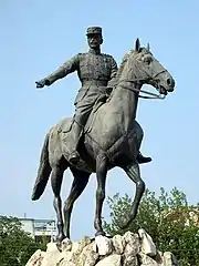
- Nikolaos Plastiras, Greek army officer and Prime Minister
- Georgios Siantos, communist politician, Greek Resistance figure
- Dimitrios Tsiamis, Greek triple jumper, bronze medalist at European Championships
- Panagiota Tsinopoulou, Greek Olympian race walker
- Stefanos Tsitsipas, Greek tennis player
See also
Gallery
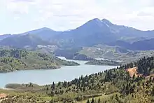 Lake Plastiras, near the city
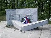 Monument to Greco-Russian friendship at Lake Plastira
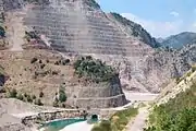 Dam of Sykia
 View to Argithea
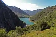 Stefaniada lake
References
- "Απογραφή Πληθυσμού - Κατοικιών 2011. ΜΟΝΙΜΟΣ Πληθυσμός" (in Greek). Hellenic Statistical Authority.
- Arrowsmith, John. "Turkey in Europe, 1832".
- Leake, William Martin. Travels in Northern Greece. (1835).
- Kallikratis law Greece Ministry of Interior (in Greek)
- "Population & housing census 2001 (incl. area and average elevation)" (PDF) (in Greek). National Statistical Service of Greece. Archived from the original (PDF) on 2015-09-21.
External links
 Media related to Karditsa at Wikimedia Commons
- Karditsa Wireless Metropolitan Network, Karditsas Wifi Community Network (in Greek)
Administrative division of the Thessaly Region | ||
|---|---|---|
| Regional unit of Karditsa | 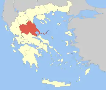 | |
| Regional unit of Larissa | ||
| Regional unit of Magnesia | ||
| Regional unit of the Sporades | ||
| Regional unit of Trikala | ||
| ||
| Authority control |
|---|