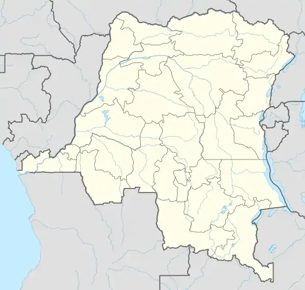
Kasumbalesa, Democratic Republic of the Congo
Kasumbalesa is a border town in the Democratic Republic of the Congo. It sits across the international border from the much smaller town of Kasumbalesa, Zambia.[1]
Kasumbalesa | |
|---|---|
 Kasumbalesa Location in Democratic Republic of the Congo | |
| Coordinates: 12°15′23″S 27°48′10″E | |
| Country | |
| Province | Haut-Katanga |
| Elevation | 4,660 ft (1,420 m) |
| Population (2004 Estimate) | |
| • Total | 47,213 |
| Climate | Cwa |
Location
Kasumbalesa is located in Haut-Katanga Province, approximately 100 kilometres (62 mi), south-east of Lubumbashi, the provincial headquarters.[2] The geographical coordinates of Kasumbalesa are: 12°15'23.0"S, 27°48'10.0"E (Latitude:-12.256389; Longitude:27.802778).[3] Kasumbalesa sits at an average elevation of 1,420 metres (4,659 ft) above sea level.[4]
Population
The national census, conducted on 1 July 1984, enumerated the population of the town at 31,773 people. As of 1 July 2004, the town's population was estimated at 47,213.[5]
- The 1984 census data is sourced from the National Institute of Statistics of the Democratic Republic of the Congo.[5]
- The 2004 population estimate is sourced from the United Nations Organization Stabilization Mission in the Democratic Republic of the Congo.[5]
Overview
Kasumbalesa is a major crossing point for both human traffic and cargo for both Democratic Republic of the Congo and Zambia. It is the main conduit of trade that amounted to US$575 million that DR Congo imported from Zambia compared to US$1.7 billion that Zambia imported from its northern neighbor, based on 2015 data.[6] An average of over 500 long-haul cargo trucks are cleared daily in each direction.[1] In April 2019, the traffic at the border crossing snarled, leading to congestion on both sides of the border.[7]
References
- Chawe, Michael (12 May 2019). "Zambia DRC Border Post Set For Facelift". The EastAfrican. Nairobi. Retrieved 17 May 2019.
- Globefeed.com (17 May 2019). "Distance between Lubumbashi, Katanga Province, Democratic Republic of the Congo and Kasumbalesa, Katanga Province, Democratic Republic of the Congo". Globefeed.com. Retrieved 17 May 2019.
- Google (17 May 2019). "Location of Kasumbalesa, Democratic Republic of the Congo" (Map). Google Maps. Google. Retrieved 17 May 2019.
- Floodmap (2019). "Elevation of Kasumbalesa, Democratic Republic of the Congo". Floodmap.net. Retrieved 17 May 2019.
- Citypopulation.de (30 September 2017). "Population of Kasumbalesa, Haut-Katanga Province, Democratic Republic of the Congo". Citypopulation.de. Retrieved 17 May 2019.
- Peter Munaita, and Michael Chawe (16 April 2019). "Congestion At Border Slows Down Zambia, DRC Trade". The EastAfrican. Nairobi. Retrieved 17 May 2019.
- Liesl Venter (8 April 2019). "Kasumbalesa Queue Now 72 Kilometers Long". FTW Online. Johannesburg: Now Media (Private) Limited. Retrieved 17 May 2019.
External links
- Kasumbalesa Border Post (ZAM/DRC) 06h00-18h00 As of 16 May 2019.