Katzenbuckel
The Katzenbuckel (626 metres) is an extinct volcano and the highest elevation in the Odenwald region. The mountain is located eastwards of Eberbach, near the village of Waldbrunn. At the top of the Katzenbuckel is an 18-m-high lookout, built out of sandstone. If the weather is good, it is possible to see the Donnersberg (83 km away) and the surrounding secondary mountains (Taunus). When the view is exceptionally clear, it is theoretically possible to see the Kreuzberg (120 km away) in the Rhön. It translates directly into 'cat hump'.
| Katzenbuckel | |
|---|---|
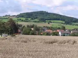 View to the Katzenbuckel | |
| Highest point | |
| Elevation | 626 m (2,054 ft) |
| Prominence | 251 m (823 ft) |
| Isolation | 71 km (44 mi) |
| Coordinates | 49°28′15″N 9°02′28″E |
| Naming | |
| English translation | Cat's arched back |
| Language of name | German |
| Geography | |
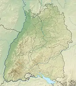 Katzenbuckel The location within Baden-Württemberg | |
| Location | Baden-Württemberg, Germany |
| Parent range | Odenwald |
This article is issued from Wikipedia. The text is licensed under Creative Commons - Attribution - Sharealike. Additional terms may apply for the media files.