Kawardha
Kawardha is a city and a municipality in Kabirdham district in the Indian state of Chhattisgarh. It is the administrative headquarters of Kabirdham district. Kawardha is also known for the "Temple of Bhoramdeo."
Kawardha | |
|---|---|
city | |
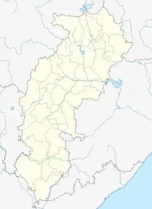 Kawardha Location in Chhattisgarh, India  Kawardha Kawardha (India) | |
| Coordinates: 22.02°N 81.25°E | |
| Country | |
| State | Chhattisgarh |
| District | Kabirdham |
| Government | |
| • Body | municipality |
| • MLA | Mohammad Akbar |
| Area | |
| • Total | 2,066 km2 (798 sq mi) |
| Elevation | 353 m (1,158 ft) |
| Population (2012) | |
| • Total | 45,451 |
| • Density | 22/km2 (57/sq mi) |
| Languages | |
| • Official | Hindi, Chhattisgarhi |
| Time zone | UTC+5:30 (IST) |
| PIN | 491995 |
| Area code(s) | 7741 |
| Vehicle registration | CG-09 |
| Website | kawardha |
The Member of Legislative assembly from Kawardha is Mohammed Akbar of Congress,He is also a cabinet minister in Chhattisgarh government. The collector of Kawardha is Shri Ramesh kumar Sharma. [1]
History
Kawardha State was established in 1751 by first Ruler Mahabali Singh. During the British Raj Kawardha was the capital of Kawardha State, one of the princely states of the Eastern States Agency.[2] In 1806 the Eighth Guru of Kabeer panth Haq Nam Saheb established a Guru Gaddi here. In 1936 Kawardha town became a municipality before independence. The famous Bhoramdev Temple is in the town.
Geography
Kawardha is located at 22.02°N 81.25°E.[3] The total area is 798 square miles (2,070 km2).[4] The state consists of hill and forest. It has an average elevation of 353 metres (1,158 ft).
Demographics
At the 2011 India census,[5] Kawardha had a population of 44,205. Males constitute 52% of the population and females 48%. Kawardha has an average literacy rate of 66%, higher than the national average of 59.5%: male literacy is 76%, and female literacy is 55%. In Kawardha, 15% of the population is under 6 years of age.
Web portals
Internet penetration is gaining pace in Kawardha.
| Website name | URL | Notes |
|---|---|---|
| Kawardha - Government Website | http://kawardha.gov.in/ | Official government website for the city. Land records and other e-governance projects are available from here. |
| District Environment Authority | http://www.environmentclearance.nic.in/Deiaa_OnlineSearch.aspx?type=ALLEC&state_id=33&distrcit_id=628 | Mining of Minor Minerals Clearances |
| Kawardha- Zila Panchayat Website | http://www.zpkawardha.cgpanchayat.gov.in/ | Official website of the Zila Panchayat of Kawardha |
References
- Dr. Sanjay Alung-Chhattisgarh ki Riyaste/Princely stastes aur Jamindariyaa (Vaibhav Prakashan, Raipur1, ISBN 81-89244-96-5)
- Dr.Sanjay Alung-Chhattisgarh ki Janjaatiyaa/Tribes aur Jatiyaa/Castes (Mansi publication, Delhi6, ISBN 978-81-89559-32-8)
- http://kawardha.gov.in
- Malleson, G. B.: An historical sketch of the native states of India, London 1875, Reprint Delhi 1984
- "Maps, Weather, and Airports for Kawardha, India". www.fallingrain.com. Retrieved 10 April 2016.
- Imperial Gazetteer of India: Provincial Series. Superintendent of Government Print. 1 January 1908.
- "Census of India 2001: Data from the 2001 Census, including cities, villages and towns (Provisional)". Census Commission of India. Archived from the original on 16 June 2004. Retrieved 1 November 2008.