Kaya, Burkina Faso
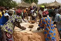
Kaya is the fifth largest city in Burkina Faso, lying northeast of Ouagadougou, to which it is connected by railway. It is a centre for weaving and tanning.
Kaya, Burkina Faso | |
|---|---|
Regional capital | |
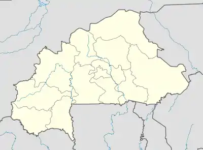 Kaya, Burkina Faso Location within Burkina Faso, French West Africa | |
| Coordinates: 13°05′00″N 01°05′00″W | |
| Country | Burkina Faso |
| Region | Centre-Nord |
| Province | Sanmatenga |
| Government | |
| • Mayor | Boukaré OUEDRAOGO |
| Elevation | 353 m (1,158 ft) |
| Population (2019 census)[1] | |
| • Total | 122,949 |
| Time zone | UTC+0 (GMT) |
Kaya is the capital of Sanmatenga Province. It is located 100 kilometres (62 mi) from Ouagadougou, the capital of Burkina Faso.
Demographics
Kaya has a population of 122,949 (2019 census).[1]
Population growth:
| Year | Inhabitants |
|---|---|
| 1985 (census) | 29.359 |
| 1996 (census) | 33.958 |
| 2006 (census) | 51,778 |
Infrastructure
Kaya Airport is a public airport in Kaya. As of 2014 it did not have any scheduled commercial flights.
In 1988 Kaya was connected by railway to Ouagadougou[2] but, as of 2014, there were no passenger services available.
Kaya is a road junction for the N3 and N15 national highways that link the city with Dori, Ouagadougou and Pouytenga, Boulsa, Kongoussi and Ouahigouya, respectively.
Education
- technical college for girls
- secondary school
Climate
Köppen-Geiger climate classification system classifies its climate as hot semi-arid (BSh).
| Climate data for Kaya | |||||||||||||
|---|---|---|---|---|---|---|---|---|---|---|---|---|---|
| Month | Jan | Feb | Mar | Apr | May | Jun | Jul | Aug | Sep | Oct | Nov | Dec | Year |
| Average high °C (°F) | 32 (90) |
35.3 (95.5) |
37.9 (100.2) |
39.1 (102.4) |
37.8 (100.0) |
35.1 (95.2) |
32.2 (90.0) |
30.8 (87.4) |
32.1 (89.8) |
36.1 (97.0) |
35.3 (95.5) |
32.5 (90.5) |
34.7 (94.5) |
| Daily mean °C (°F) | 24.3 (75.7) |
27.2 (81.0) |
30.3 (86.5) |
32.2 (90.0) |
31.4 (88.5) |
29 (84) |
27.1 (80.8) |
26.1 (79.0) |
26.9 (80.4) |
29.4 (84.9) |
27.6 (81.7) |
24.8 (76.6) |
28.0 (82.4) |
| Average low °C (°F) | 16.6 (61.9) |
19.2 (66.6) |
22.7 (72.9) |
25.3 (77.5) |
25 (77) |
23 (73) |
22 (72) |
21.4 (70.5) |
21.8 (71.2) |
22.8 (73.0) |
19.9 (67.8) |
17.2 (63.0) |
21.4 (70.5) |
| Average precipitation mm (inches) | 0 (0) |
0 (0) |
4 (0.2) |
13 (0.5) |
41 (1.6) |
98 (3.9) |
153 (6.0) |
207 (8.1) |
111 (4.4) |
21 (0.8) |
0 (0) |
0 (0) |
648 (25.5) |
| Source: Climate-Data.org, altitude: 331m[3] | |||||||||||||
Sister cities
 Herzogenaurach, Germany
 Châtellerault, France
 Savannah, Georgia, United States
See also
References
- Citypopulation.de Population of the major cities in Burkina Faso
- Historical Dictionary of Burkina Faso, by Lawrence Rupley, Lamissa Bangali, Boureima Diamitani, 2013, third edition, Scarecrow Press, Inc. ISBN 978-0-8108-6770-3
- "Climate: Kaya - Climate graph, Temperature graph, Climate table". Climate-Data.org. Retrieved 19 October 2013.