Keokradong
Keokradong is a peak located in Bandarban, Bangladesh, with an elevation of 986 metres (3,235 ft).[2] Some sources claim it as the highest point of Bangladesh.
| Keokradong | |
|---|---|
.jpg.webp) Keokradong | |
| Highest point | |
| Elevation | 986 m (3,235 ft) |
| Prominence | 400 m (1,300 ft) [1] |
| Isolation | 13 km (8.1 mi) |
| Listing | List of mountains of Bangladesh |
| Coordinates | 21°56′59″N 92°30′51″E |
| Geography | |
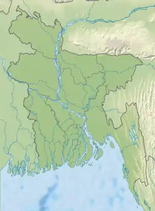 Keokradong Location in Bangladesh, near the border with Myanmar | |
| Location | Ruma Upazila, Bandarban |
| Geology | |
| Mountain type | Mountain |
.jpg.webp)
Panorama from the top of Keokradong.
On the top of Keokradong there is a small shelter and a signboard put up by Bangladesh Army proclaiming the elevation to be 967 metres (3,173 ft).
Height measured by handheld GPS shows it is 986 metres (3,235 ft) with 3m accuracy.[3]
There is a controversy about the highest point of Bangladesh, and some sources indicate Saka Haphong as the most elevated peak of the country.[4]
Keokradong is a popular tourist attraction in Bangladesh for mountaineers.[5] Keokradong is one of the most cloudiest place of Bangladesh.
Notes
- SRTM data
- Elevation extremes, CIA: the World Factbook.
- Keokradong, Banglatrek Archived 2011-07-25 at the Wayback Machine, Banglatrek.org.
- "Mowdok Mual, Bangladesh". Peakbagger.com.
- "A Hiker's Guide to Keokradong". The Daily Star. 2016-03-17. Retrieved 2020-08-21.
This article is issued from Wikipedia. The text is licensed under Creative Commons - Attribution - Sharealike. Additional terms may apply for the media files.