Keratea
Keratea (Greek: Κερατέα) is a town in East Attica, Greece. Since the 2011 local government reform it is part of the municipality Lavreotiki, of which it is a municipal unit. The municipal unit has an area of 129.864 km2.[2][3] It is part of Athens metropolitan area.
Keratea
Κερατέα | |
|---|---|
 Keratea Location within the regional unit 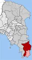 | |
| Coordinates: 37°48′N 23°58′E | |
| Country | Greece |
| Administrative region | Attica |
| Regional unit | East Attica |
| Municipality | Lavreotiki |
| • Municipal unit | 129.864 km2 (50.141 sq mi) |
| Elevation | 158 m (518 ft) |
| Population (2011)[1] | |
| • Municipal unit | 14,763 |
| • Municipal unit density | 110/km2 (290/sq mi) |
| Time zone | UTC+2 (EET) |
| • Summer (DST) | UTC+3 (EEST) |
| Postal code | 190 01 |
| Area code(s) | 22990 |
| Vehicle registration | Z |
| Website | www.keratea.gr |
Geography
Keratea is situated in the hills in the southeastern part of the Attica peninsula, 6 km west of the Aegean Sea coast, at about 200 m elevation. It lies at the northern foot of Mount Paneion. It is 5 km southeast of Kalyvia Thorikou, 12 km northwest of Lavrio and 29 km southeast of Athens city centre. Greek National Road 89 (Gerakas - Koropi - Lavrio - Sounio) passes through Keratea.
In antiquity, the area of present Keratea was part of the deme Cephale, of the phyle Acamantis in Mesogeia area of Ancient Athens.
Historical population
| Year | Town population | Municipality population |
|---|---|---|
| 1981 | 7,511 | - |
| 1991 | 6,512 | 9,715 |
| 2001 | 7,472 | 11,205 |
| 2011 | 7,493 | 14,763 |
Historical monuments
The church of St. Athanasius (Kronizes).[4] A wall painting monument (1744) of George Markou the Argus, the great and prolific post-Byzantine ecclesiastic iconographer of the 18th century (".... Il Santo Athanasio, che si trova alla Regione Cronizes di Kerateas dell 'Attica...." Evangelos Andreou http://ketlib.lib.unipi.gr/xmlui/handle/ket/849 )
Sports
Keratea hosts the sport teams Keravnos Keratea F.C., one of the most successful East Attica football clubs, and the multi-sport G.S. Kerateas (Gymnastikos Syllogos Kerateas), the women's volleyball team has represent the town in Greek A1 Division for several years.
See also
- List of municipalities of Attica
References
- "Απογραφή Πληθυσμού - Κατοικιών 2011. ΜΟΝΙΜΟΣ Πληθυσμός" (in Greek). Hellenic Statistical Authority.
- "Population & housing census 2001 (incl. area and average elevation)" (PDF) (in Greek). National Statistical Service of Greece. Archived from the original (PDF) on 2015-09-21.
- Kallikratis law Greece Ministry of Interior (in Greek)
- ".:BiblioNet : Γεώργιος Μάρκου ο Αργείος / Ανδρέου, Ευάγγελος". www.biblionet.gr. Retrieved 2018-11-16.
External links
- Official website (in Greek, link to English version available)
- http://members.tripod.com/~Mesogia_Keratea/
- https://web.archive.org/web/20060515075537/http://www.athleticsclubkeratea.org/
- Antenna on Keratea's hydrogen factory (in Greek)
- "Violence spikes in Greek rebel town" by Elena Becatoros, The Independent, 16 April 2011
- http://www.forkeratea.com Η ηλεκτρονικη αρχειοθηκη δημοσιευσεων που αφορουν την πολη της Κερατεας και το δημο Λαυρεωτικής.
Places adjacent to Keratea | ||||||||||
|---|---|---|---|---|---|---|---|---|---|---|
| ||||||||||