Kfarchouba
Kfarchouba (Arabic: كفرشوبا), also known as Kafarchouba and Kfar Shuba, is a Lebanese village in the Hasbaya District of the Nabatieh Governorate in Southern Lebanon. It is situated in the region of Arkoub, at 1256 m above sea level and 130 km from Beirut. Located on the borders of Israel and the Golan Heights, not far from the Shebaa Farms, it overlooks in depth both Israel and the Lebanese Bekaa, which makes it a strategic military location. Hezbollah claims that Israel is still occupying the general area in which the village is located, known as the Kfar Chouba Hills.[1] It stands in mountainous terrain.
Kfarchouba
كفرشوبا | |
|---|---|
Village | |
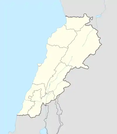 Kfarchouba Location within Lebanon | |
| Coordinates: 33.328059°N 35.6571451°E | |
| Country | |
| Governorate | Nabatieh Governorate |
| District | Hasbaya District |
| Area | |
| • Total | 37 km2 (14 sq mi) |
| (including its hills) | |
| Elevation | 1,256 m (4,121 ft) |
| Population | |
| • Total | 1,000 (another 8,500 people from the village are living abroad) |
| Time zone | UTC+2 (EET) |
| • Summer (DST) | UTC+3 (EEST) |
| Dialing code | +961 |
History
The village was occupied by Israeli troops during a punitive mission, in the wake of fedayeen attacks inside Israel, on the 26 of February 1972,[2] and was devastated by a major Israeli attack conducted in January 1975.[3][4] It was bombed and rocketed by Israeli warcraft further on 15 June, and shelled again by Israeli artillery on 31 August, of that year.[5][6]
It was struck by Israeli air raids and artillery fire in April 2002.[7]
During the Israeli invasion in 2006, 60 houses were completely destroyed, and 650 were damaged. Currently, over 90% of the population of Kfarchouba lives outside Lebanon. A total of 800 houses make up the village. The school was rebuilt in the 90s. After the return of some immigrants in 2006, a second section was built.
In retaliation for a Hezbollah retaliatory strike against an Israeli patrol on the 28 January 2015, the village was shelled by IDFF artillery fire, together with the two other border villages of Majidiyeh, Abbasiyeh.[8]
The mosque in the village was destroyed in 1972 and partially rebuilt.
Kfarchouba is the second largest village in southern Lebanon, which also contains the largest number of young graduates in the Caza of Hasbaya.
Landmarks
- The Shkif (in Arabic الشقيف)
- Ajami, and Mobaraki Sheikh Salam: Considered to be The three major holy chains.
Large families and notables
- Largest families: Al-Kadri (القادري), Kassab (قصب), Abdallah (عبدالله), Diab (ذياب), Ghanem (زز), Chibli (غانم), Khebbaiz (خبيز)
- President of the municipal council: Dr Kassem El Kadiri
- Mayors: Mohammad Kassab (Abu Naser), Mohamad Hamed, Ali Salah Diab
- Director of Secondary school: Mohamad El Kadiri
- Director of primary school: Ahmad Toufic Kassab
Agriculture
Kfarchouba farms produce olives (over 100 tonnes in 2006 including olive oil), figs, grapes, and cherries.
References
- Hezbollah says its arms needed to resist Israel, Al Arabiya, 20 November 2010.
- Denise Ammoun,Histoire du Liban contemporain, tome 2: 1943-1990, Fayard, 2005 p.234.
- Samir Khalaf Civil and Uncivil Violence in Lebanon:A History of the Internationalization of Communal Conflict, Columbia University Press 2013 p.226
- Nadine Picaudou La déchirure libanaise, Editions Complexe,1989 p.121.
- 'Report on the status of the cease-fire in the Israel-Lebanon sector,' UNISPAL June 16, 1975.
- 'Letter dated 4 September 1975 from the Permanent Representative of Lebanon to the United Nations addressed to the Secretary-General,' UNISPAL 4 September 1975.
- 'Israel hits back at Hezbollah,'BBC News, 5 April 2002.
- Richard Hall, 'Hezbollah kills two Israeli soldiers in border attack,' GlobalPost 28 January 2015.
External links
- Kfar Chouba (Nkhayleh), Localiban
- www.kafarchouba.com
Capital: Hasbaya | ||
| Towns and villages | 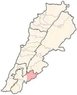 | |
| Other | ||