King River (Kimberley, Western Australia)
The King River is a river in the Kimberley of Western Australia.
| King River | |
|---|---|
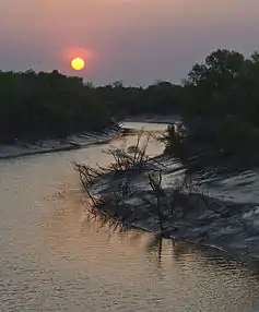 Sunset over the King River as seen from the King River Road | |
| Location | |
| Country | Australia |
| Physical characteristics | |
| Source | |
| • location | Durack Range |
| • elevation | 387 metres (1,270 ft)[1] |
| Mouth | |
• location | Cambridge Gulf |
• elevation | sea level |
| Length | 132 kilometres (82 mi) |
The headwaters of the river rise between the Durack Range and the Saw Range. It flows southwards before turning north and continuing until it discharges into the West Arm of the Cambridge Gulf just South of Wyndham.
The river was named in 1884 during hydrographic surveys by Staff Commander James Coghlan after Captain Phillip Parker King who was the first European to chart the river mouth in 1818.[2]
The river flooded in 2005 following heavy rainfall when Cyclone Ingrid crossed the coast in the area. At Diggers Rest Station near Wyndham fences and livestock were swept away.[3]
The Indigenous Australian name for the river is Goolime and traditional owners of the areas around the river are the Ngarinjin, for the area around its headwaters.[4]
References
- "Bonzle Digital Atlas – Map of King River River". 2009. Retrieved 10 July 2016.
- Western Australian Land Information Authority. "History of river names – K". Retrieved 7 September 2011.
- Adrienne Francis (17 March 2005). "Tragedy strikes Kimberley station". Australian Broadcasting Corporation. Retrieved 4 May 2012.
- Norman Tindale, Aboriginal Tribes of Australia: Their Terrain, Environmental Controls, Distribution, Limits, and Proper Names, Australian National University 1974 p.251.
External links
![]() Media related to King River (Kimberley, Western Australia) at Wikimedia Commons
Media related to King River (Kimberley, Western Australia) at Wikimedia Commons
Rivers of Western Australia | |
|---|---|
| Rivers of the Gascoyne region | |
| Rivers of the Goldfields-Esperance region | |
| Rivers of the Great Southern region | |
| Rivers of the Kimberley region |
|
| Rivers of the Mid West region | |
| Rivers of the Peel and Perth regions | |
| Rivers of the Pilbara region | |
| Rivers of the South West region | |
| Rivers of the Wheatbelt region | |
| |