Peel (Western Australia)
The Peel region is one of the nine regions of Western Australia. It is located on the west coast of Western Australia, about 75 km (47 mi) south of the state capital, Perth. It consists of the City of Mandurah, and the Shires of Boddington, Murray, Serpentine-Jarrahdale and Waroona.
Peel | |
|---|---|
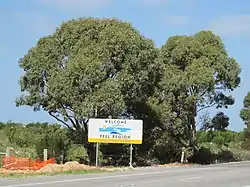
 Welcome to Peel Region sign | |
| Coordinates: 32°31′47″S 115°43′30″E[1] | |
| Country | Australia |
| State | Western Australia |
| Subdivisions | City of MandurahShire of BoddingtonShire of MurrayShire of Serpentine-JarrahdaleShire of Waroona |
| Area | |
| • Total | 6,648 km2 (2,567 sq mi) |
| Population (2017) | |
| • Total | 136,854 |
| • Density | 21/km2 (53/sq mi) |
It has a total area of 6,648 km².[3] In 2017, Peel had a population of 136,854, of which over sixty percent lived in Mandurah.[4]
The economy of the Peel region is dominated by mining and mineral processing; the area has large reserves of bauxite, some gold and mineral sands, and an aluminium refinery. Other important economic sectors include agriculture and a substantial equine industry.
Before European settlement, the Peel region was inhabited by Indigenous Australians, specifically the Pindjarup dialect group of the Noongar people. Shortly after the establishment of the Swan River Colony in 1829, part of the northern coastal area of the Peel region was settled under a program known as the Peel Settlement Scheme, organised by Thomas Peel. However the scheme was poorly administered, and many settlers died of malnutrition in the first few months. The surviving settlers abandoned the area, with some moving inland where they found fertile soil.
In 1846, Western Australia's first mining operation was established at Yarrabah (near present-day Mundijong, mining lead, silver and zinc. The Jarrahdale timber mill, established in May 1872, became the state's largest timber operation, and led to the development of service centres for the timber industry along the Perth–Picton railway line at Mundijong, Waroona and Dwellingup. In recent times, the timber industry has declined, but the establishment of alumina refineries at Pinjarra and Wagerup, and gold mines at Boddington, have helped the local economy.
See also
Notes
- "Place Name Search: Peel Region". Gazetteer of Australia Place Name Search. Commonwealth of Australia (Geoscience Australia). 2012. Retrieved 20 July 2012.
- "Place Name Search: Peel Region". Gazetteer of Australia Place Name Search. Commonwealth of Australia (Geoscience Australia). 2012. Retrieved 20 July 2012.
- Compare: Peel - the developing region : Peel Region profile, 1991. Mandurah, W.A : South West Development Authority, 1991. http://henrietta.liswa.wa.gov.au/record=b1526662~S2 Archived 28 September 2013 at the Wayback Machine with Urban growth monitor : Perth metropolitan, Peel and Greater Bunbury regions : Urban Development Program. Perth, W.A. : Western Australian Planning Commission, 2010. ISBN 0-7309-9995-5 (pbk.) http://henrietta.liswa.wa.gov.au/record=b2917368~S2 Archived 28 September 2013 at the Wayback Machine for the changes in 20 years in relation to growth and urban development
- "Peel Fast Facts" (PDF). peel.wa.gov.au. Peel Development Commission. November 2019. Retrieved 16 May 2020.