Kiripaka
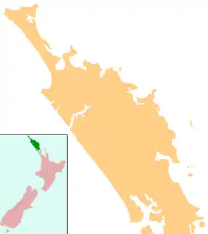
Kiripaka is a locality in Northland, New Zealand. The settlement of Glenbervie lies to the southwest, and Ngunguru is to the northeast.
Kiripaka | |
|---|---|
 Kiripaka | |
| Coordinates: 35.644°S 174.429°E | |
| Country | New Zealand |
| Region | Northland Region |
| District | Whangarei District |
"Kiripaka" means flint, schist or asbestos in the Māori language.[1]
Demographics
| Year | Pop. | ±% p.a. |
|---|---|---|
| 2006 | 717 | — |
| 2013 | 888 | +3.10% |
| 2018 | 993 | +2.26% |
| Source: [2] | ||
The statistical area of Kiripaka, which at 72 square kilometres is much larger than this locality, had a population of 993 at the 2018 New Zealand census, an increase of 105 people (11.8%) since the 2013 census, and an increase of 276 people (38.5%) since the 2006 census. There were 333 households. There were 498 males and 495 females, giving a sex ratio of 1.01 males per female. Of the total population, 228 people (23.0%) were aged up to 15 years, 114 (11.5%) were 15 to 29, 513 (51.7%) were 30 to 64, and 141 (14.2%) were 65 or older. Figures may not add up to the total due to rounding.
Ethnicities were 85.2% European/Pākehā, 22.7% Māori, 3.3% Pacific peoples, 2.1% Asian, and 0.9% other ethnicities. People may identify with more than one ethnicity.
The percentage of people born overseas was 13.0, compared with 27.1% nationally.
Although some people objected to giving their religion, 58.0% had no religion, 29.9% were Christian, and 4.2% had other religions.
Of those at least 15 years old, 168 (22.0%) people had a bachelor or higher degree, and 114 (14.9%) people had no formal qualifications. The median income was $35,400. The employment status of those at least 15 was that 411 (53.7%) people were employed full-time, 132 (17.3%) were part-time, and 36 (4.7%) were unemployed.[2]
Mining
A coal mine was opened at Kiripaka in 1893[3] and produced "first-class steam coal".[4] A second mine was opened across the river in 1899.[5] One of the mines closed in late 1904, as it was no longer profitable.[6] The remaining mine was closed in 1912 in response to miners taking a day off to support the Waihi miners' strike.[7] The mine reopened at the end of 1914[8] although coal output didn't begin until August 1915.[9] After industrial disputes and flooding, the mine closed permanently in June 1921[10] although fire clay was extracted from 1923[11] and there was some further coal mining at the end of the decade.[12]
Notes
- "Kiripaka". Māori Dictionary.
- "Statistical area 1 dataset for 2018 Census". Statistics New Zealand. March 2020. Kiripaka (105700). 2018 Census place summary: Kiripaka
- "Kiripaka Coal Mine". Northern Advocate. 25 March 1893. p. 2.
- "Untitled". New Zealand Herald. 3 July 1893. p. 4.
- "New Coal Mine at Kiripaka". Auckland Star. 22 May 1899. p. 6.
- "Kiripaka Coal Mine". Auckland Star. 17 November 1904. p. 5.
- "Mass Meeting on Saturday". Northern Advocate. 17 November 1913. p. 5.
- "Northern Coal Company". Auckland Star. 15 December 1914. p. 4.
- "Ngunguru". Northern Advocate. 27 August 1915. p. 1.
- "Local & General". Northern Advocate. 15 June 1921. p. 2.
- "Ngunguru News". Northern Advocate. 13 April 1923. p. 2.
- "Northern Coal Mines". Auckland Star. 17 September 1929. p. 16.