Kladnitsa Peak
Kladnitsa Peak (Bulgarian: връх Кладница, romanized: vrah Kladnitsa, IPA: [ˈvrɤx ˈkɫadnit͡sɐ]) is the ice-covered peak of elevation 1000 m on Pernik Peninsula, Loubet Coast in Graham Land, Antarctica. It surmounts McCance Glacier to the south and west, and Darbel Bay to the northeast.
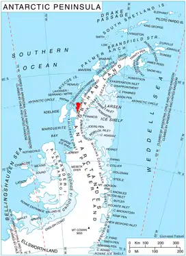
Location of Pernik Peninsula on Loubet Coast, Antarctic Peninsula.
The peak is named after the settlement of Kladnitsa in Western Bulgaria.
Location
Kladnitsa Peak is located at 66°46′14″S 65°50′08″W, which is 7.36 km east of Liebig Peak, 5 km south-southeast of Rubner Peak, 10.68 km southwest of Sokol Point and 9.77 km west-northwest of Ushlinova Peak. British mapping in 1976.
Maps
- Antarctic Digital Database (ADD). Scale 1:250000 topographic map of Antarctica. Scientific Committee on Antarctic Research (SCAR). Since 1993, regularly upgraded and updated.
- British Antarctic Territory. Scale 1:200000 topographic map. DOS 610 Series, Sheet W 66 64. Directorate of Overseas Surveys, Tolworth, UK, 1976.
References
- Bulgarian Antarctic Gazetteer. Antarctic Place-names Commission. (details in Bulgarian, basic data in English)
- Kladnitsa Peak. SCAR Composite Antarctic Gazetteer
External links
- Kladnitsa Peak. Copernix satellite image
This article includes information from the Antarctic Place-names Commission of Bulgaria which is used with permission.
This article is issued from Wikipedia. The text is licensed under Creative Commons - Attribution - Sharealike. Additional terms may apply for the media files.
