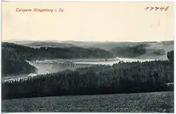
Klingenberg, Saxony
Klingenberg is a municipality in the Sächsische Schweiz-Osterzgebirge district, in Saxony, Germany. It was formed on 31 December 2012 by the merger of the former municipalities Pretzschendorf and Höckendorf.
Klingenberg | |
|---|---|
 | |
Location of Klingenberg within Sächsische Schweiz-Osterzgebirge district 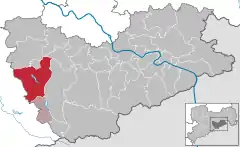 | |
 Klingenberg 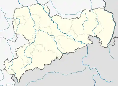 Klingenberg | |
| Coordinates: 50°54′N 13°33′E | |
| Country | Germany |
| State | Saxony |
| District | Sächsische Schweiz-Osterzgebirge |
| Subdivisions | 11 |
| Area | |
| • Total | 86.56 km2 (33.42 sq mi) |
| Population (2019-12-31)[1] | |
| • Total | 6,781 |
| • Density | 78/km2 (200/sq mi) |
| Time zone | UTC+01:00 (CET) |
| • Summer (DST) | UTC+02:00 (CEST) |
| Postal codes | 01738, 01744, 01774 |
| Dialling codes | 035055, 035202, 035058, 037326 |
| Vehicle registration | PIR |
| Website | www |
Geography
The municipality is located 20 kilometers south-west of Dresden and 10 kilometers west of Dippoldiswalde.
Klingenberg consists of 11 subdivisions: Beerwalde, Borlas, Colmnitz (including Folge), Friedersdorf, Höckendorf (including Edle Krone), Klingenberg, Obercunnersdorf, Paulshain, Pretzschendorf, Röthenbach and Ruppendorf.
Transport
Klingenberg is located along Dresden–Werdau railway, having two stations within its limits: Klingenberg-Colmnitz (located in the boroughs of Klingenberg and Colmnitz) and Edle Krone (located in the village of Höckendorf). At Klingenberg-Colmnitz station two narrow-gauge railway lines used to branch off until the early 1970s, connecting also the villages of Colmnitz and Pretzschendorf to the rail network.
References
- "Bevölkerung des Freistaates Sachsen nach Gemeinden am 31. Dezember 2019". Statistisches Landesamt des Freistaates Sachsen (in German). July 2020.
| Authority control |
|---|