Ko Kut District
Ko Kut (Thai: เกาะกูด, pronounced [kɔ̀ʔ kùːt]) is a district (amphoe) of Trat Province, eastern Thailand, consisting of a group of islands. With a population of about 2,000 it is the district with the smallest population of all Thailand.
Ko Kut
เกาะกูด | |
|---|---|
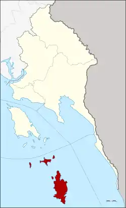 District location in Trat Province | |
| Coordinates: 11°39′30″N 102°32′32″E | |
| Country | Thailand |
| Province | Trat |
| Seat | Ko Kut |
| Area | |
| • Total | 162.2 km2 (62.6 sq mi) |
| Population (2007) | |
| • Total | 2,118 |
| • Density | 13.1/km2 (34/sq mi) |
| Time zone | UTC+7 (ICT) |
| Postal code | 23000 |
| Geocode | 2306 |


History
Originally the area of the district was part of the sub-district (tambon) Ko Chang, Laem Ngop District. In 1952 the sub-district Ko Mak was established to cover the whole island, at that time subdivided into four villages (mubans).[1] In 1980 three villages of Ko Mak were split off to create sub-district Ko Kut.[2] On 1 April 1990 the government upgraded tambon Ko Kut together with tambon Ko Mak to a minor district (king amphoe).[3]
The Thai government on 15 May 2007 upgraded all 81 minor districts to full districts.[4] With publication in the Royal Gazette on 24 August the upgrade became official.[5]
As local government entities, the two tambon administrative organizations (TAO) were created in 2003 and 2004 respectively. The Tambon Council Ko Kut was upgraded to a TAO in 2003,[6] and Ko Mak in 2004.[7]
Geography
The largest island in the district, Koh Kood, is a major island dotted with seaside villages and coconut plantations. It is about 60 minutes from the mainland by speedboat.
Administration
The district is divided into two sub-districts (tambons), which are further subdivided into eight villages (mubans). There are two tambon administrative organizations (TAO), one for each sub-district.
| No. | Name | Thai | Villages | Pop. |
|---|---|---|---|---|
| 1. | Ko Mak | เกาะหมาก | 2 | 403 |
| 2. | Ko Kut | เกาะกูด | 6 | 1,715 |
References
- ประกาศกระทรวงมหาดไทย เรื่อง ตั้งและเปลี่ยนแปลงเขตตำบลในท้องที่อำเภอแหลมงอบ จังหวัดตราด (PDF). Royal Gazette (in Thai). 69 (43 ง): 2008–2009. 1952-07-08.
- ประกาศกระทรวงมหาดไทย เรื่อง ตั้งและเปลี่ยนแปลงเขตตำบลในท้องที่อำเภอแหลมงอบ จังหวัดตราด (PDF). Royal Gazette (in Thai). 97 (150 ง): 3391. 1980-09-30.
- ประกาศกระทรวงมหาดไทย เรื่อง แบ่งเขตท้องที่อำเภอแหลมงอบ จังหวัดตราด ตั้งเป็นกิ่งอำเภอเกาะกูด (PDF). Royal Gazette (in Thai). 109 (25 ง): 1351. February 13, 1990.
- แถลงผลการประชุม ครม. ประจำวันที่ 15 พ.ค. 2550 (in Thai). Manager Online.
- พระราชกฤษฎีกาตั้งอำเภอฆ้องชัย...และอำเภอเหล่าเสือโก้ก พ.ศ. ๒๕๕๐ (PDF). Royal Gazette (in Thai). 124 (46 ก): 14–21. August 24, 2007.
- ประกาศกระทรวงมหาดไทย เรื่อง จัดตั้งองค์การบริหารส่วนตำบล (PDF). Royal Gazette (in Thai). 120 (พิเศษ 146 ง): 20. 2003-12-22.
- ประกาศกระทรวงมหาดไทย เรื่อง จัดตั้งองค์การบริหารส่วนตำบลเกาะหมาก กิ่งอำเภอเกาะกูด จังหวัดตราด และองค์การบริหารส่วนตำบลวังประจัน อำเภอควนโดน จังหวัดสตูล (PDF). Royal Gazette (in Thai). 121 (พิเศษ 64 ง): 7–8. 2004-06-09.
